Under-ice in Cañon Fiord
Ellesmere Island | Northern Canada
Date of acquisition: June 12th, 2024 | 21:21:09 UTC
Sensor: Sentinel-2 L2A
Coordinates: ca. 80.2°N, 83.1°W
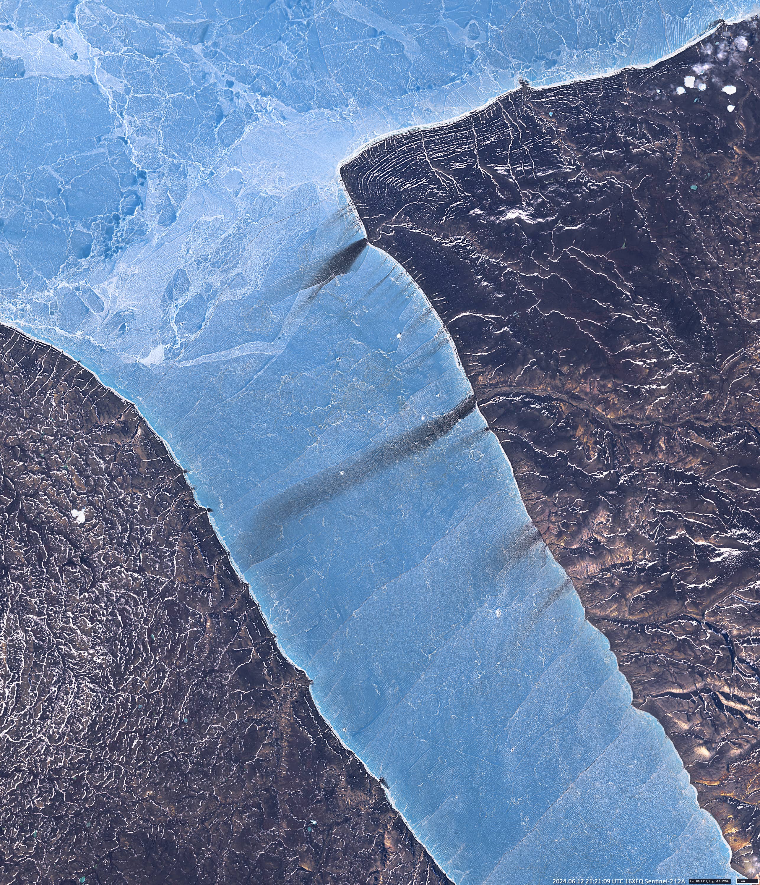
Cañon Fiord is a natural inlet to the west of Ellesmere Island, Nunavut in the Arctic Archipelago, Canada. It flows into Greely Fiord to the north and Agassiz Ice Cap to the east. At the beginning of summer, from mid-June, when the sun shines almost around the clock, intensive melting of ice begins on the plains and in the mountains. Rivers and streams carry large amounts of sediment from the Victoria and Albert Mountains and their foothills into the ocean. Some of these flow into Cañon Fiord. Among others, it is a small river, let’s call it here Muddy Water River, which splits into several branches at its mouth. In the fjord near the mouth, a cloud of dark suspended matter forms in the water. The ice near the mouth is melting because the water from the mountains is warmer than the ice.
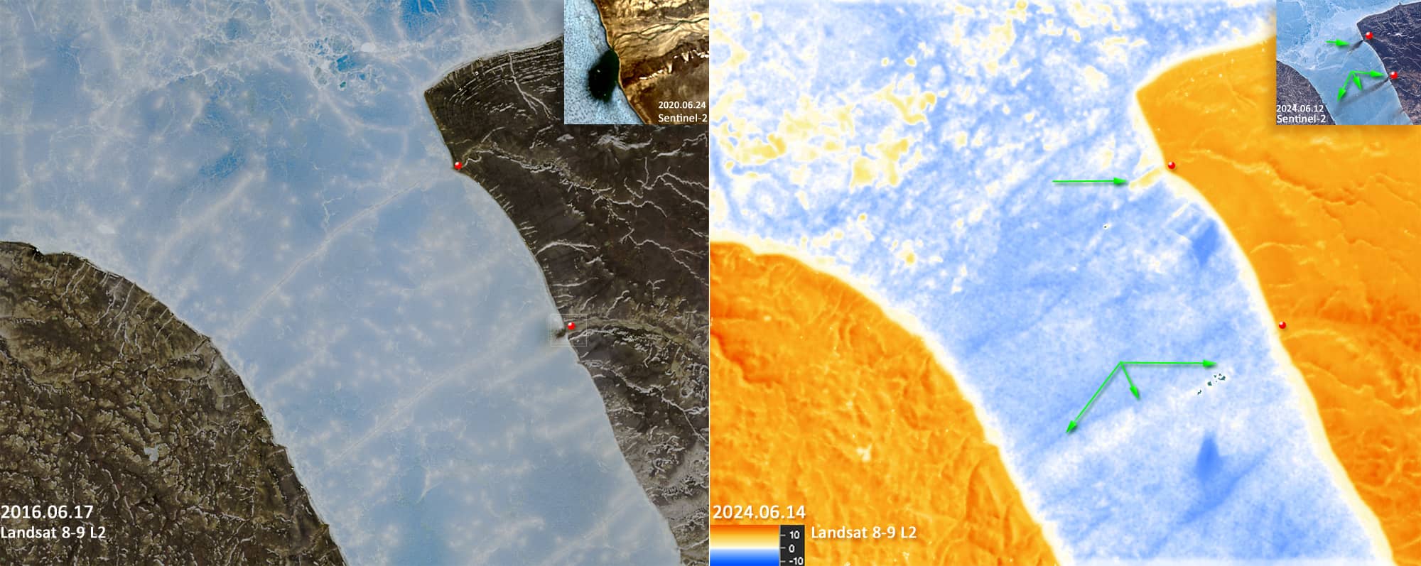
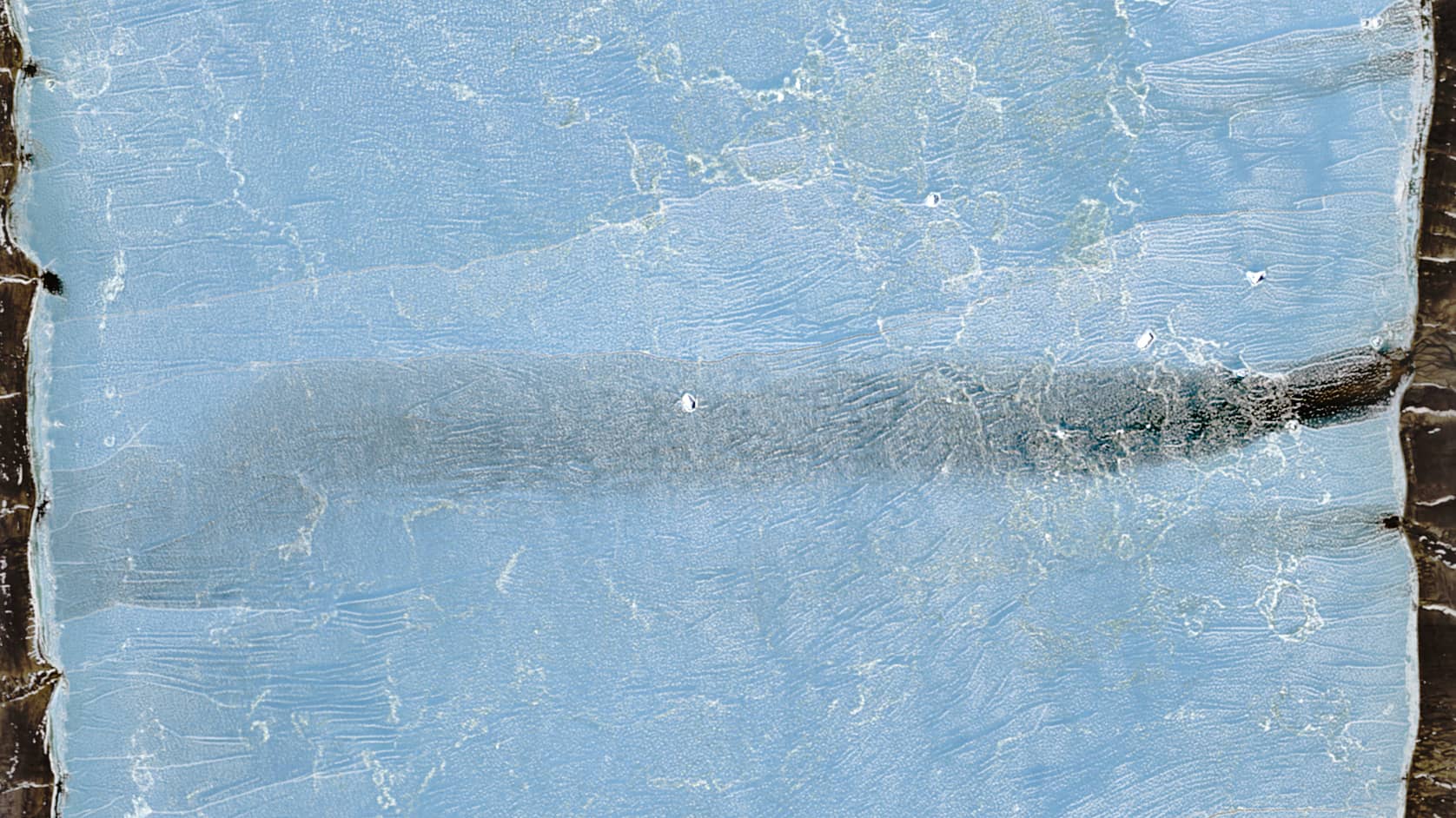
In the Sentinel 2 image of 12 June (Figure 1), shows a sediment plume extending under the ice to the opposite shore of the fjord (about 12 km). Another interesting point is the shape of the plume: it is narrow (about 1 km) and straight, i.e. it hardly diffuses into the surrounding water of the fjord. Perhaps this was influenced by the temperature (Figure 2 right) of the meltwater, its volume and velocity. Perhaps a stream of warmer, lighter freshwater has melted a straight, elongated vault in the overlying ice and flows along and under this passage, slowly cooling and losing suspended matter.
This is not only interesting, but probably quite rare, as no such phenomenon has been observed at this location in the last 10 years (based on Sentinel-2 and Landsat 8-9observations).
However, a small area of melted ice near the mouth of the Muddy Water River is common here for this time of year (Figure 2 left).
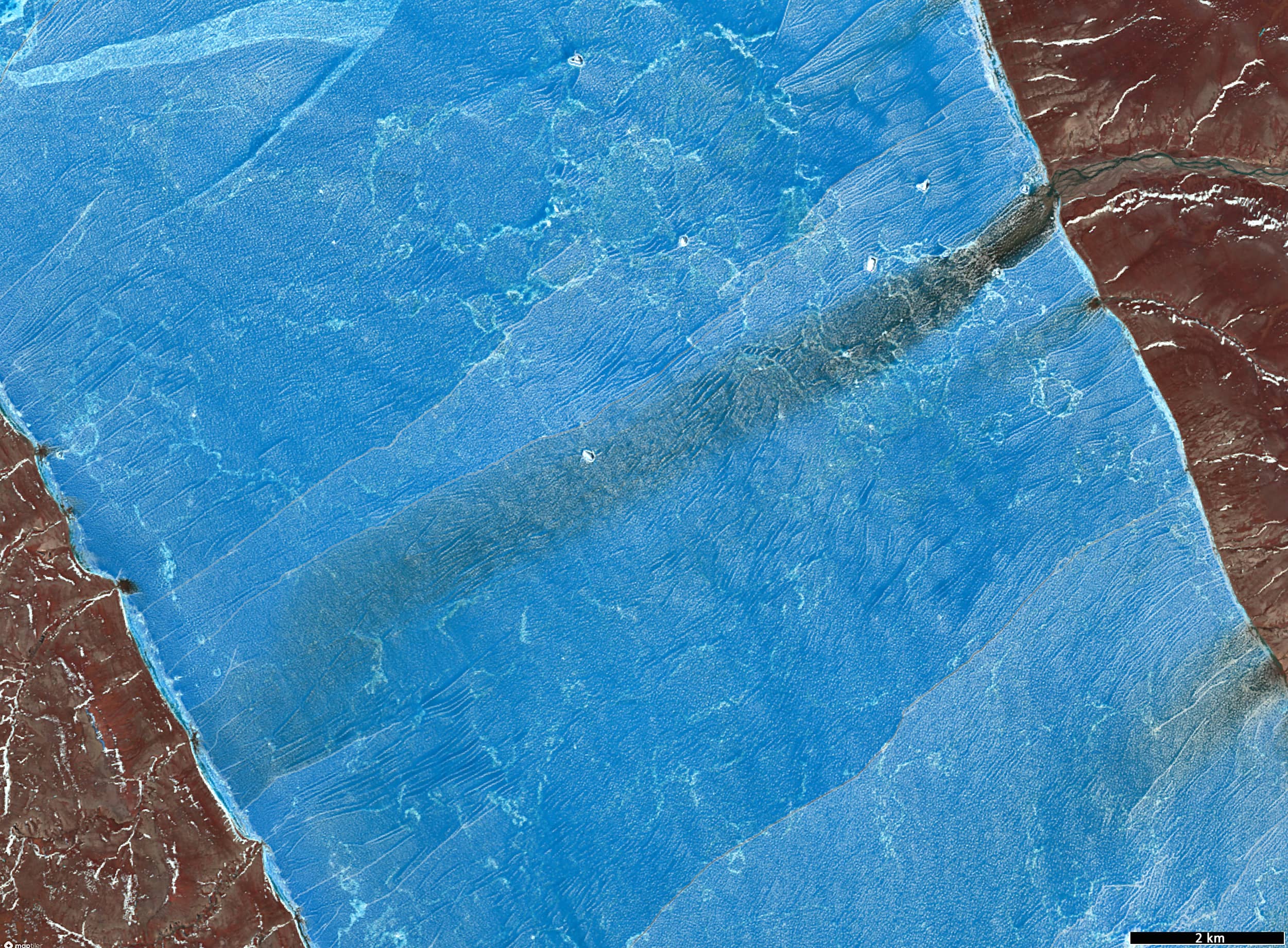
In addition, Figure 3 shows the interesting structure of the ice surface, which is dotted with lines running perpendicular to the shore. This may be the result of winds blowing into the fjord bed from the mountainous shores. Cracks in the ice that run parallel to these lines on the ice surface may be the result of tidal waves.