Typhoon Ampil
South of Japan | Pacific Ocean
Dates of acquisition:
- August 15th, 2024 (VIIRS)
- August 16th, 2024 | 01:27:52 UTC (S-2)
Sensors: VIIRS NOAA-20, Sentinel-2 L2A
Coordinates: ca. 33.66°N, 140.72°E
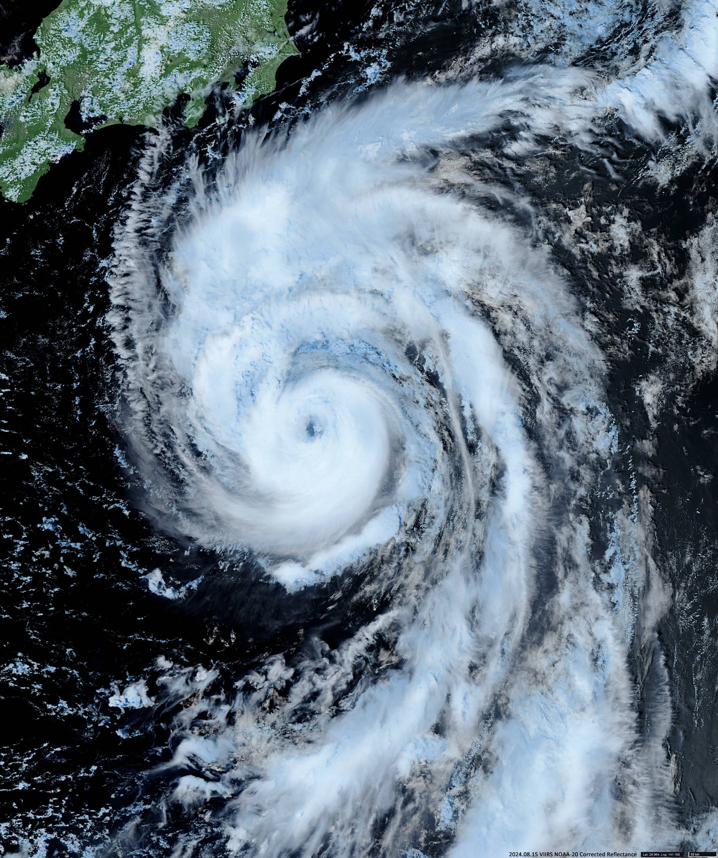
Typhoon Ampil was a powerful tropical cyclone that crossed Japan in early August 2024. The Typhoon developed from atmospheric convection and was first classified as a tropical storm named Ampil on August 12 (Figure 1). The storm gradually intensified and peaked at Category 4 typhoon strength at 03:00 UTC on August 16, with sustained winds of up to 210 km/h and atmospheric pressure at the center of the hurricane of about 960 hPa, before making its closest approach to Japan. Ampil is the first storm in the 21st century to reach the 34th parallel north or higher in the western Pacific Ocean (only two others were recorded in 1965 and in 1995).
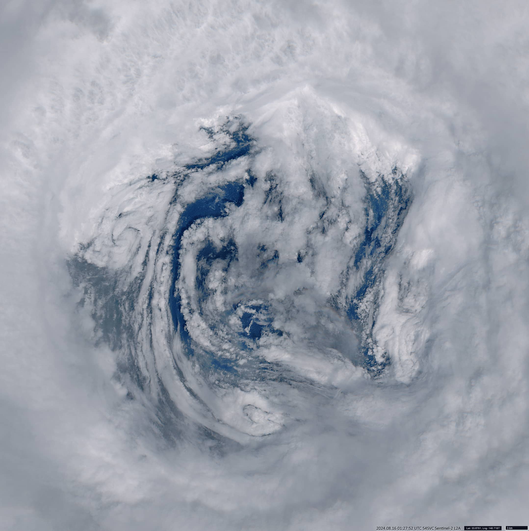
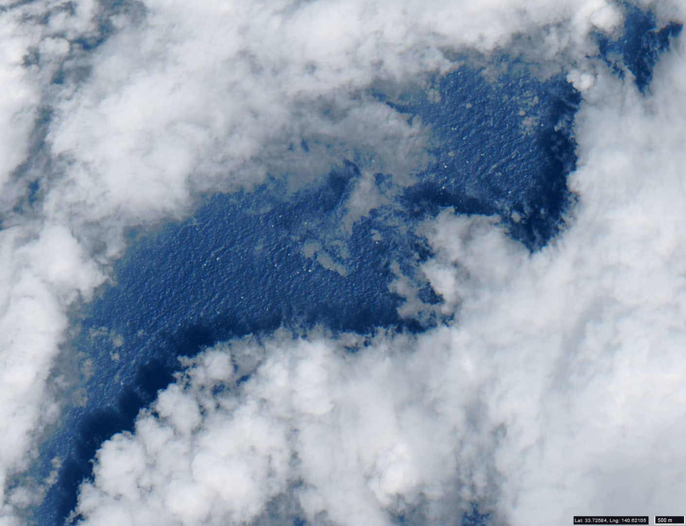
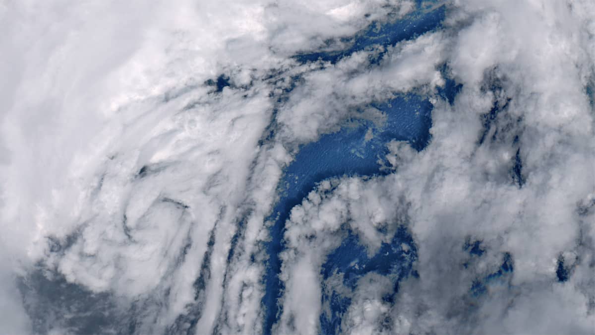
A Sentinel-2 satellite image taken at about 01:28 UTC on 16 August shows a well-defined eye, about 60 km wide and surrounded by deep convection (Figure 2). The sea and waves can be clearly seen through the cloud-free window (Figure 3). The distance between the eye and the centre of Tokyo was about 250 km at this point of time.
Ampil rapidly weakened and became extratropical on 19 August, reached the Bering Sea on 20 August, crossed the Aleutian Islands, moved inland through the Russian Far East and Arctic Alaska, reached the Arctic Ocean between 21 and 22 August, and dissipated on 23 August.