Turluri Channel Islands – Part 2
Turluri Channel | Northeast Brazil
Date of acquisition: June 1st, 2024 | 13:51:51 UTC
And many older ones; the acquisition date is indicated on each image
Sensor: Sentinel-2 L2A, Landsat 1-8
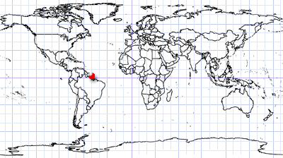
Coordinates: ca. 1.86°N, 50.28°W
Welcome to Part 2 of the Turturi Channel Islands blog post! Recall Part 1 here.
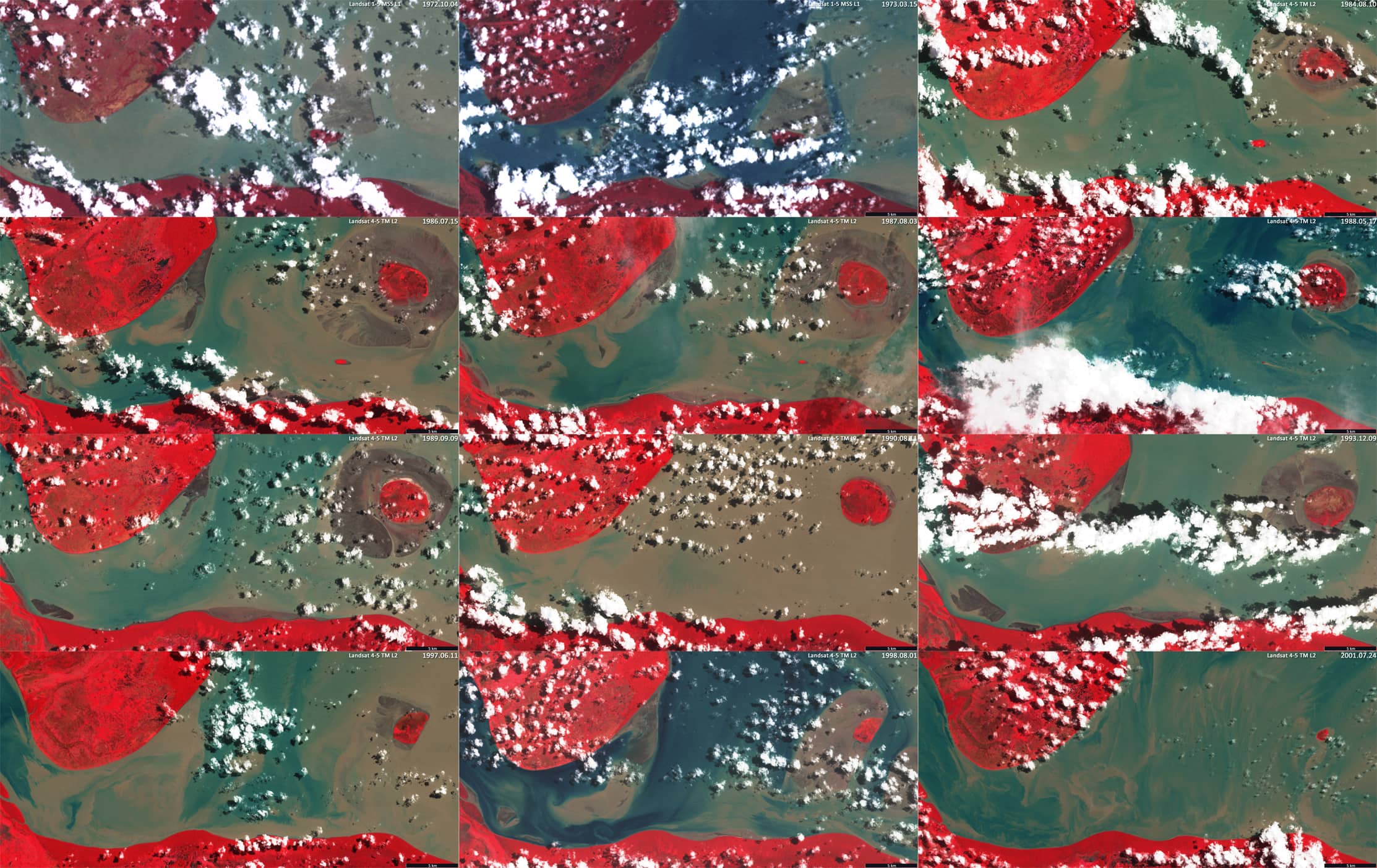
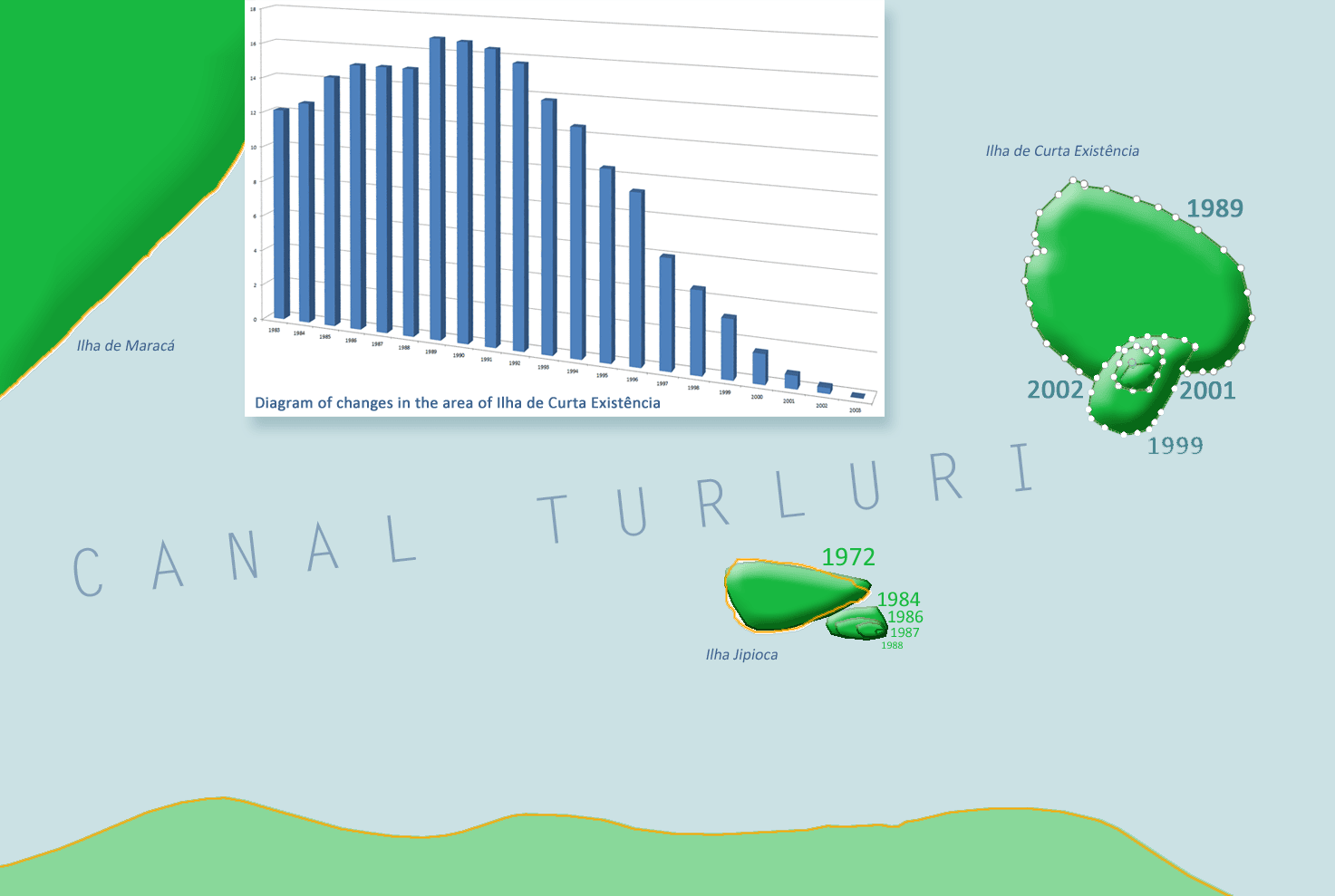
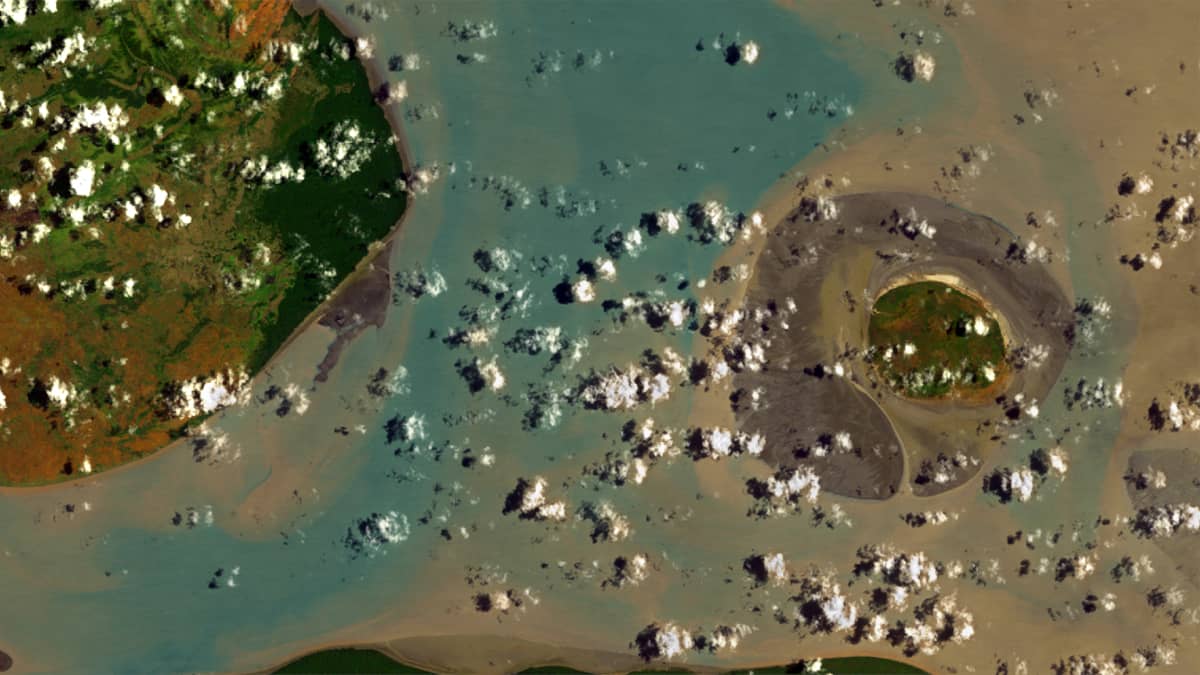
An island (as opposed to a sandbank, which often disappears at high tide) can be identified by the presence of permanent vegetation, which becomes visible in the false-colour palette (e.g. RGB[Band 4, Band 3, Band 2] for Landsat 4-5 TM L2. So, we see that in the eastern part of the channel there was an island in the period 1983-2002 [1.91°N, 50.15°W], let’s call it “Ilha de Curta Existência”. We can cautiously assume that the island has already existed since the late 1970s . At the end of the 1980s – early 1990s, the island already covered an area of 16-17 square kilometres!
At the beginning of the 1970s, in 1973, it did not yet exist. Since 1990, the island has “shifted” slightly to the south, becoming smaller and finally disappeared in the late summer of 2003, meaning that the lifespan of the Ilha de Curta Existência was 25-28 years.
Figure 1 shows the state of the last 30 years of the last millennium, 1972-2002. The focus here is on the formation and disappearance of islands in the channel.
Table: Temporal development of the island area
| Y | 1983 | 1984 | 1985 | 1986 | 1987 | 1988 | 1989 | 1990 | 1991 | 1992 | 1993 | 1994 | 1995 | 1996 | 1997 | 1998 | 1999 | 2000 | 2001 | 2002 | 2003 |
| km2 | 12.1 | 12.6 | 14.2 | 15 | 15 | 15 | 16.8 | 16.7 | 16.4 | 15.7 | 13.8 | 12.5 | 10.4 | 9.3 | 6 | 4.5 | 3.2 | 1.6 | 0.7 | 0.3 | < 0.1 |
The curve of the island’s area as a function of the time of its existence has a shape that approximates a normal distribution (see also Figure 2). Data from Landsat 1-5 satellites were used to produce the images.
Unfortunately, data for the period 1974-1983 could not be found, so it was impossible to observe the dynamics of the island’s development and the emergence of vegetation on it.
In Part 1 of this blog series we mentioned Ilha Jipioca. In 1973 it began to erode and by mid-1988 it had disappeared and is no longer visible on satellite images of recent decades.
Figure 2 shows schematically the location and shape of the islands described, as well as a histogram of the distribution of area values over time for the observed life span of Ilha de Curta Existência.