Turluri Channel Islands – Part 1
Turluri Channel | Northeast Brazil
Date of acquisition: June 1st, 2024 | 13:51:51 UTC
And many older ones; the acquisition date is indicated on each image
Sensor: Sentinel-2 L2A, Landsat 1-8
Coordinates: ca. 1.86°N, 50.28°W
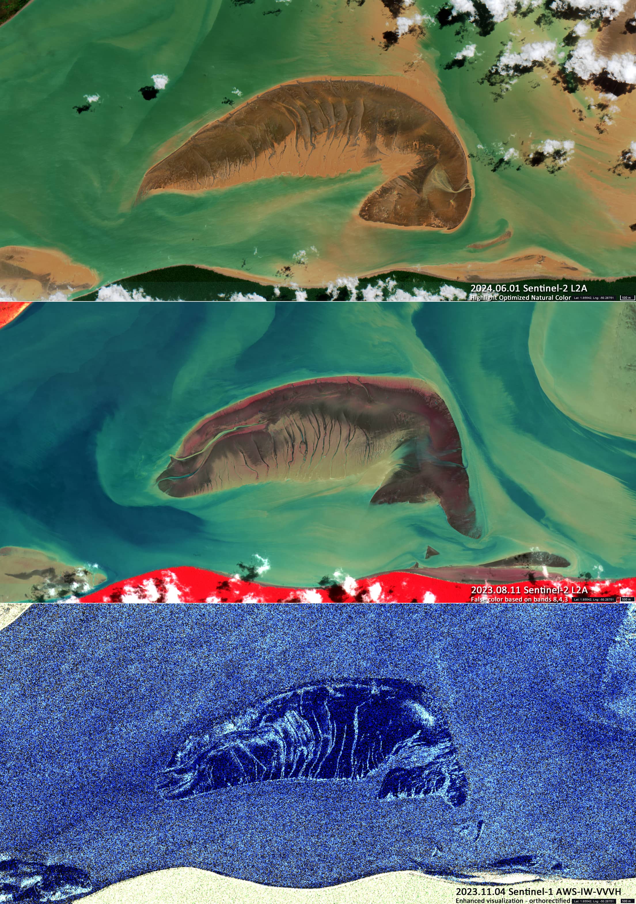
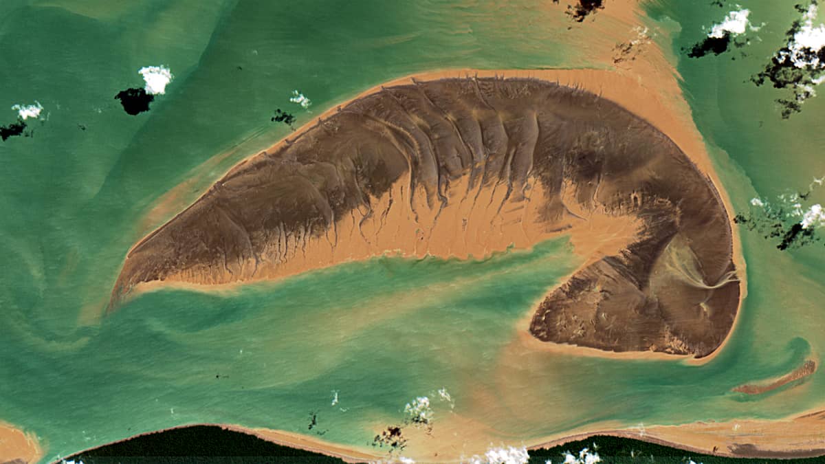
The Sentinel-2 image shows a sandbank lying in the Turluri Channel off the coast of Amapá, a municipality in the Brazilian state of Amapá, south of Maracá Island (Figure 1).
The sandbank is composed of sediments originating from the Amazon and Araguari Rivers (from the south) and the Flechal River (from the north). Its shape resembles that of a stranded sea animal – a shrimp, a fish, a whale or a manatee.
Tidal currents are very strong in this area . On equinox days, the tide rises 10 meters, and the tidal currents reach speeds of 7 knots. This is why this sandbank disappears and reappears at regular intervals.
To the north is the rather large island of Maracá . It is home to the “Maracá-Jipioca Ecological Station”established in 1981 and covers an area of more than 70,000 hectares.
The area is characterized by an estuary with extensive mangroves and floodplain forests. It is part of the Amazon biosphere. Marine and freshwater manatees, gray dolphins, giant otters and black caimans are among the aquatic species observed.
It has a tropical monsoon climate with heavy cloud cover, so the sandbank can only be seen a few times a year.
The island of Jipioca, shown on many maps, was also part of the ecological station. But it was much smaller. It was located in the Turluri Channel, east of the southern mouth of the Turluri Channel, and east of the shoal in question, and was inaccessible because it was surrounded by shallow mudflats. Due tolocal hydrodynamic conditions, the island has gradually decreased in size. It is no longer visible on satellite images of recent decades.
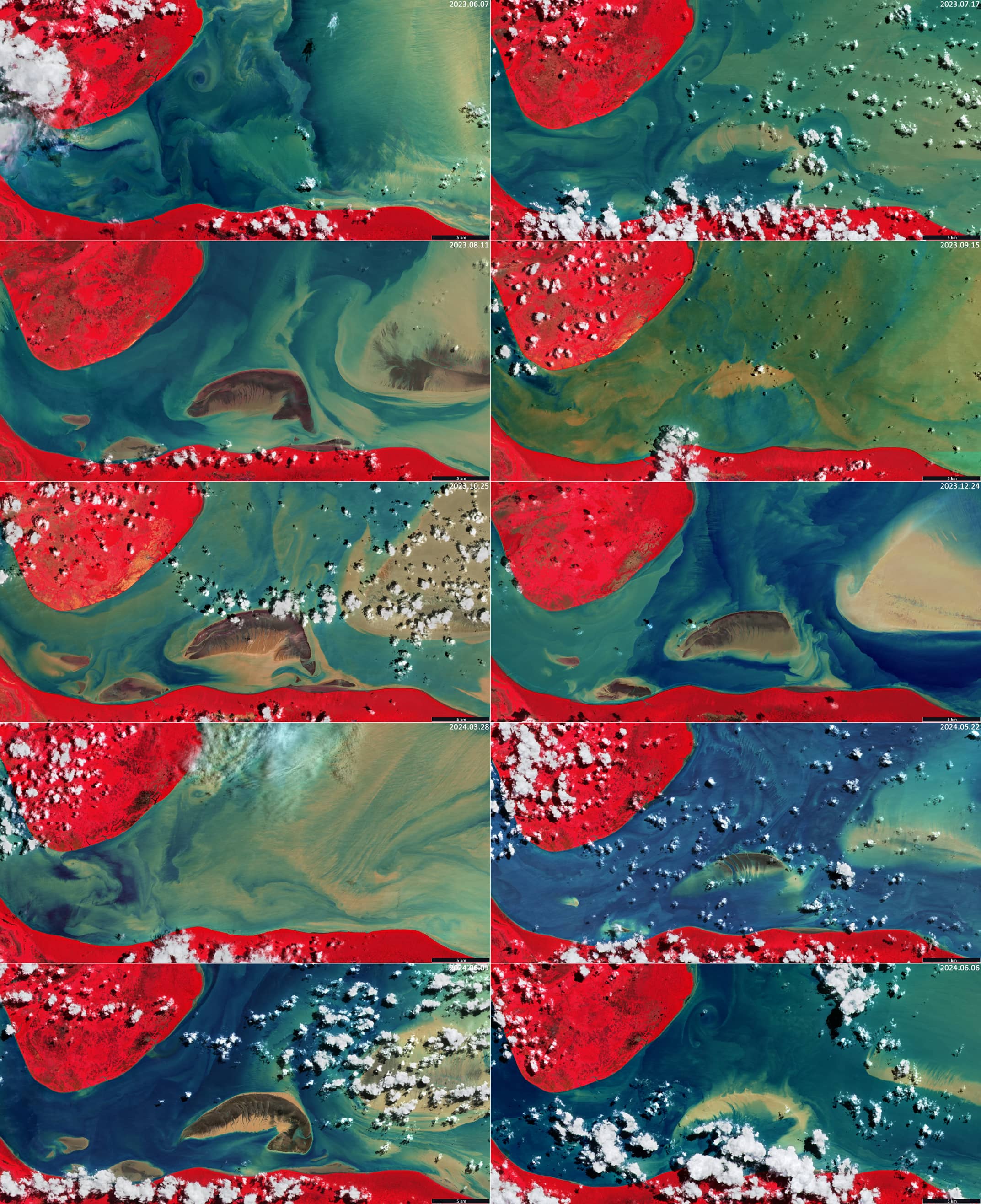
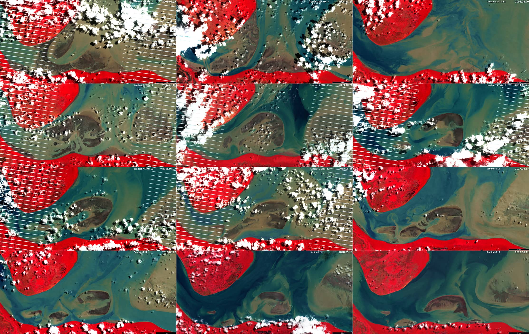
A small monitoring of changes in the position and height of sediment banks in the Turluri channelresulted in the four mosaic-images of the channel state shown in Figure 2 – Figure 3.
Figure 2 shows the current situation in the channel in 2023-2024. Here it can be observed how powerful tidal currents can either completely cover or expose the shallows in the channel. Data from the Sentinel-2 satellite were used to produce the images.
Figure 3 shows the condition over the last 20 years, 2003-2023. It can be seen that the position and shape of the shoals and the location and appearance of the water channels have changed significantly over time. Data from the Sentinel-2 and Landsat-7 satellites were used to produce the images.