Thermokarst lakes
Arga-Muora-Sise Island | Siberian Lena Delta
Dates of acquisition:
- July 16th, 2024 | 04:17:28 UTC
- July 26th, 2024 | 04:17:27 UTC
Sensor: Sentinel-2 L2A
Coordinates: ca. 73.334°N, 124.133°E
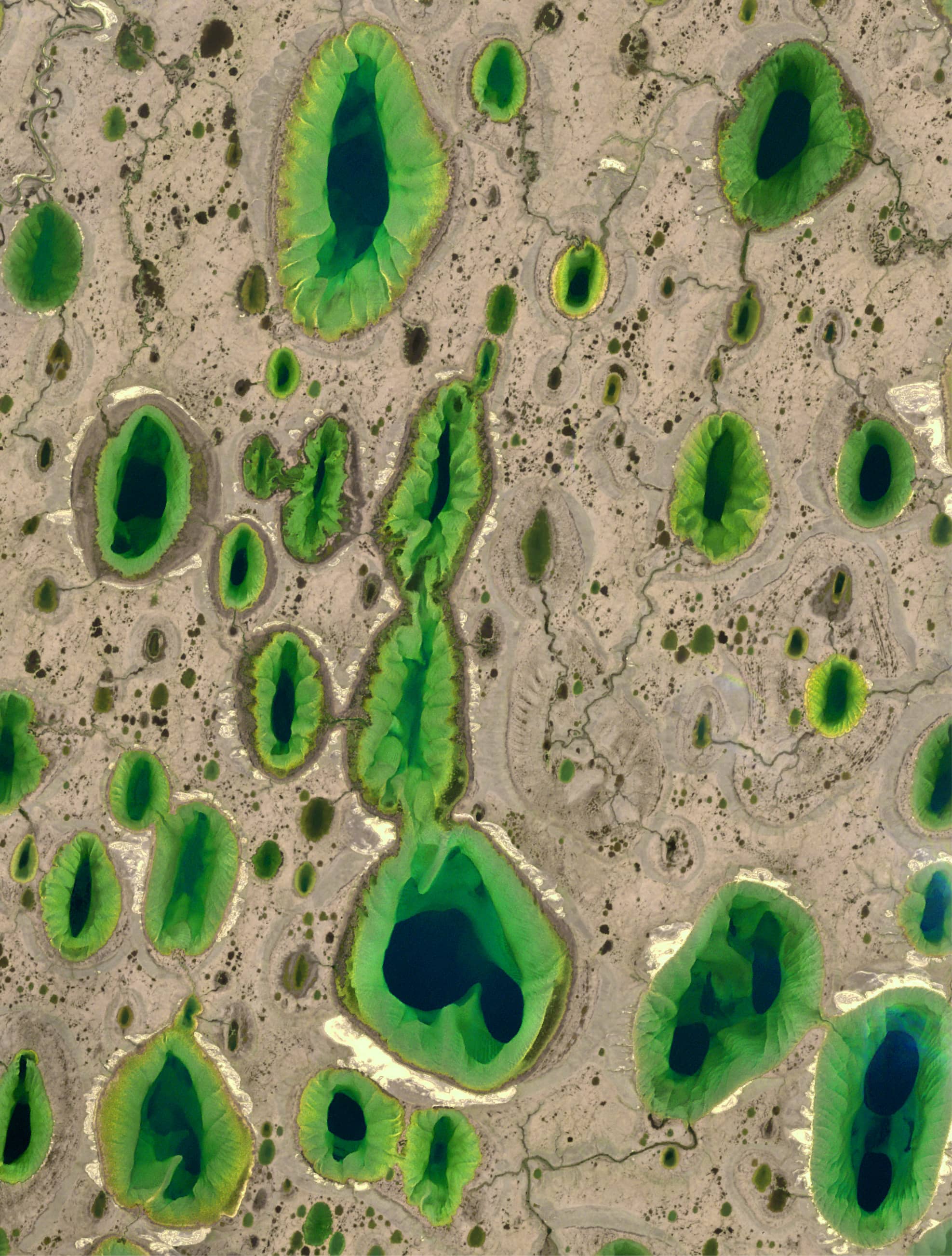
The island of Arga-Muora-Sise is located in the north-eastern part of the Siberian Lena Delta and covers an area of about 6,500 km². It is the second largest island in a single-river delta in the world after the Nile Delta, It belongs to the Republic of Sakha (Yakutia), the largest republic of Russia, and is located in the Laptev Sea. The island is assumed to be built of older alluvial marine sediments than the Lena Delta. Arga-Muora-Sise is covered with hundreds of aligned lakes, many of which are of thermokarst origin.
Thermokarst is a process of uneven subsidence of soil and underlying rock caused by the melting of underground ice. This results in the formation of funnels, sinkholes, etc., which outwardly resemblekarst landscapes. A thermokarst lake is a freshwater body that forms in a basin created by the melting of ice-rich permafrost, as the area is flat and has a positive water balance. These lakes are commonly found in the Arctic and sub-Arctic lowlands of northern Eurasia and Siberia, the western part of the Canadian Arctic and Alaska.
Some lakes are aligned in a certain direction. This is thought to be due to prevailing winds.
Nikolay-Kyule is the largest of the lakes on the island of Arga-Muora-Sise. The lake basin was formed in the Holocene and is of thermokarst origin. It covers an area of 24.5 km² (about half the size of Manhattan) and is 11 metres above sea level. The lake is 8 km longand 6 km wide. In several places the depth exceeds 20 m, while the maximum depth is about 30 m. The lake basin consists of five north-northeast-facing deep-water troughs up to 30 m deep, connected by shallow shoals up to 3 metres deep. Channels connect it with some neighboring smaller lakes (to the east). The thickness of the permafrost in this area reaches 500-600 metres, while the active layer is about 20-40 cm.
The Sentinel-2 image (Figure 1) shows the zone with the highest concentration of thermokarst lakes extending from west to east. The formation of this zone indicates the presence of a depression in the Earth’s crust at this location. The lakes of this zone we see are “living” lakes, with water and underwater ice framing the shores (yellow-green due to the shallow water) and breaking off abruptly into the depths (dark blue). Each lake has its own unique underwater pattern, which is so interesting to observe, when you notice the features of the underwater relief. And we see many “dead” lakes, where the water has drained away, leaving gaping holes in the permafrost bed.
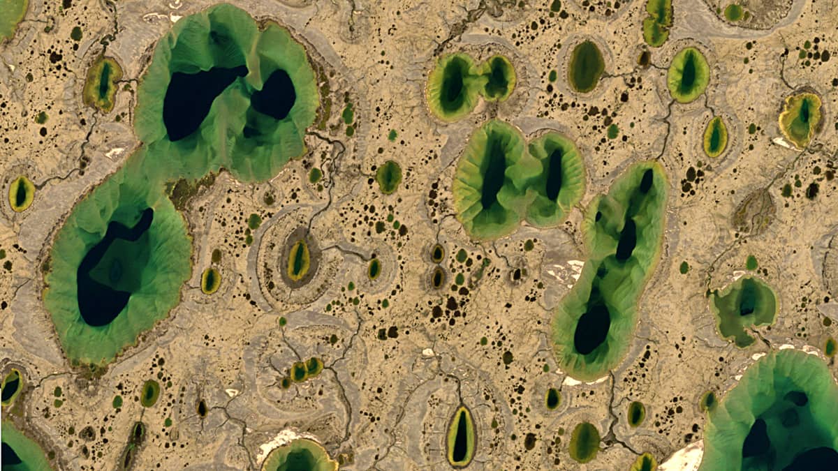
Some of the lakes are separately shown in close-up:
Fig. 1
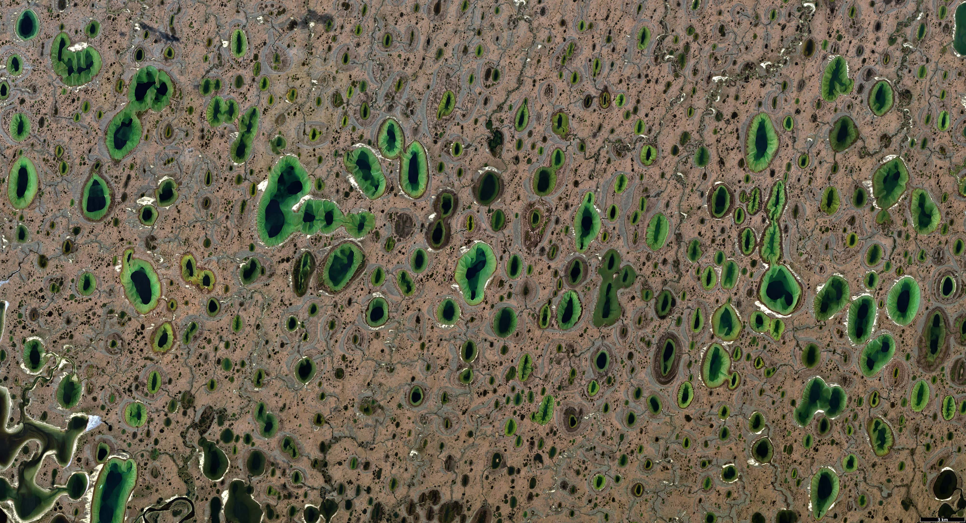
Fig. 2
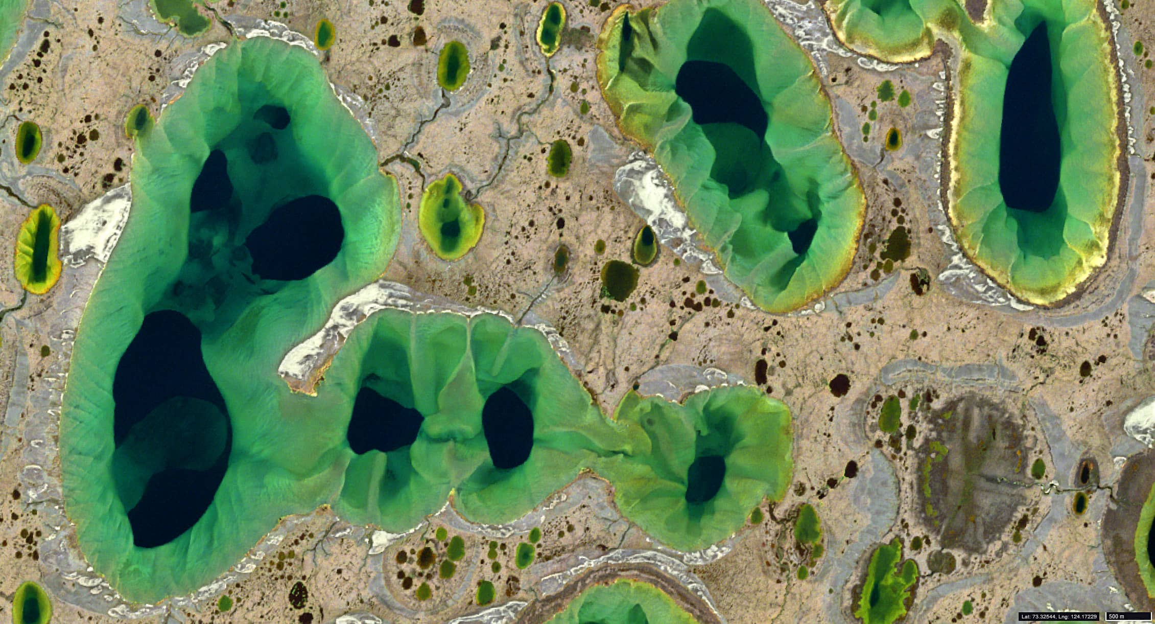
Fig. 3
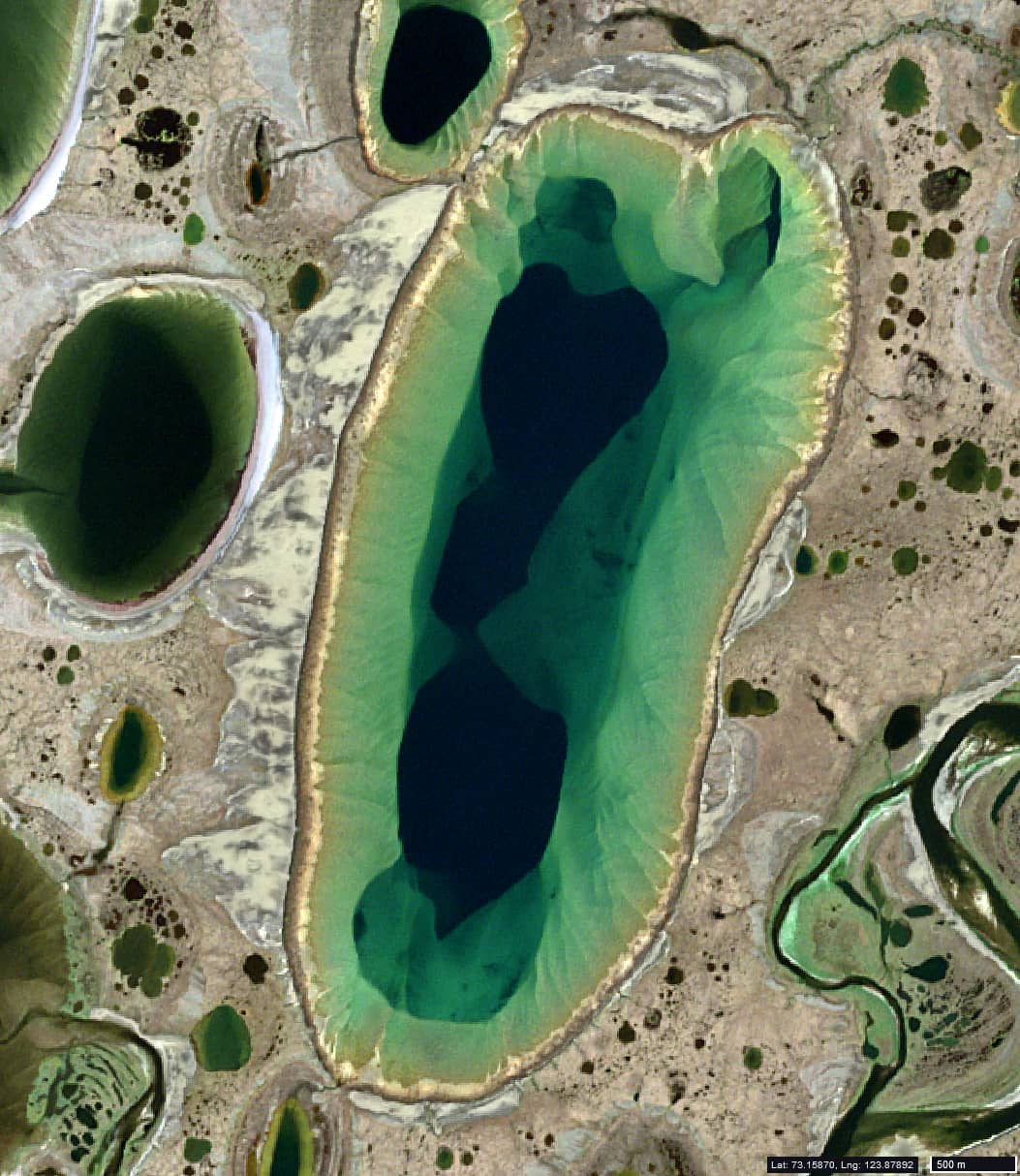
Fig. 4
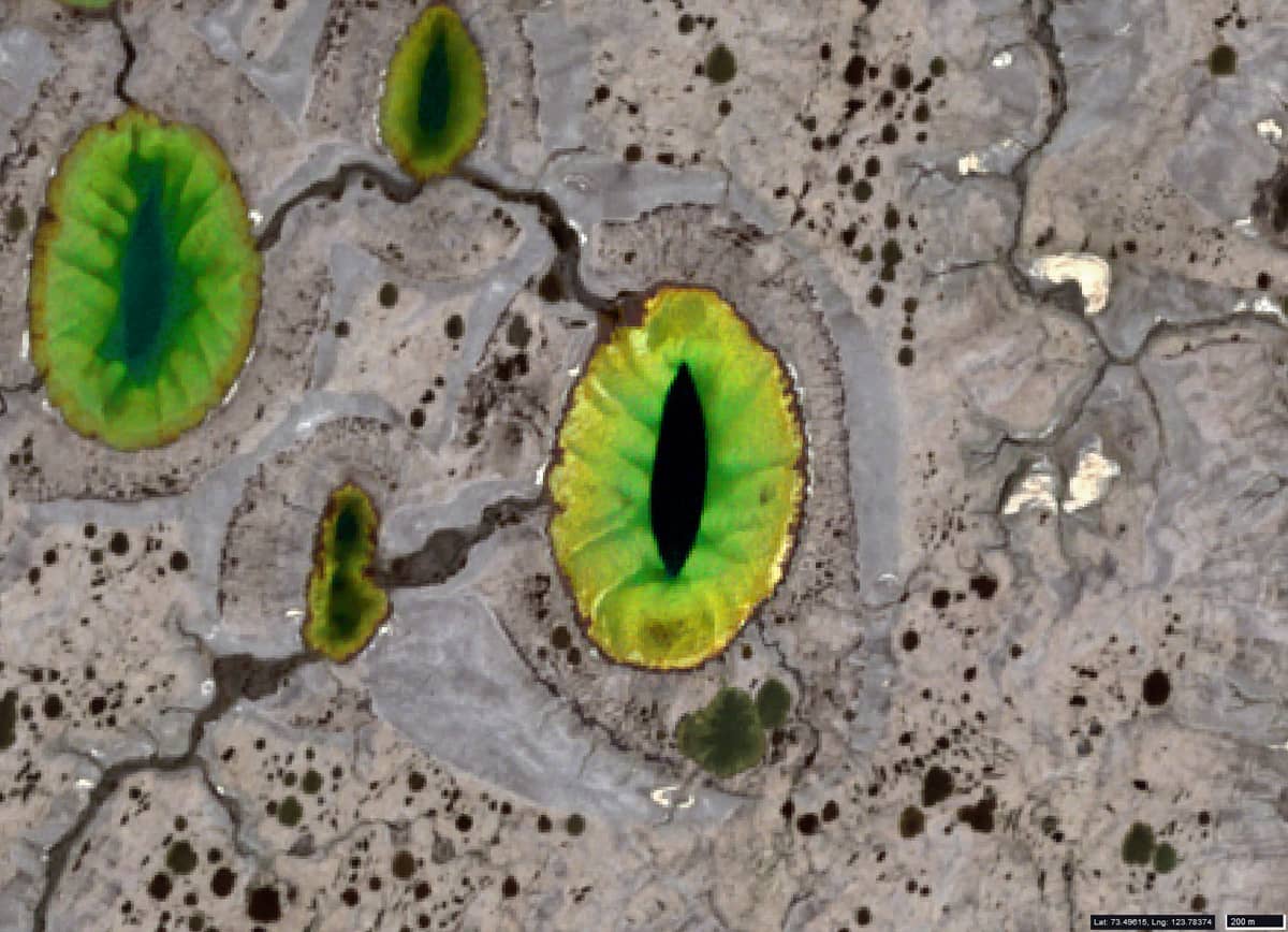
Fig. 5
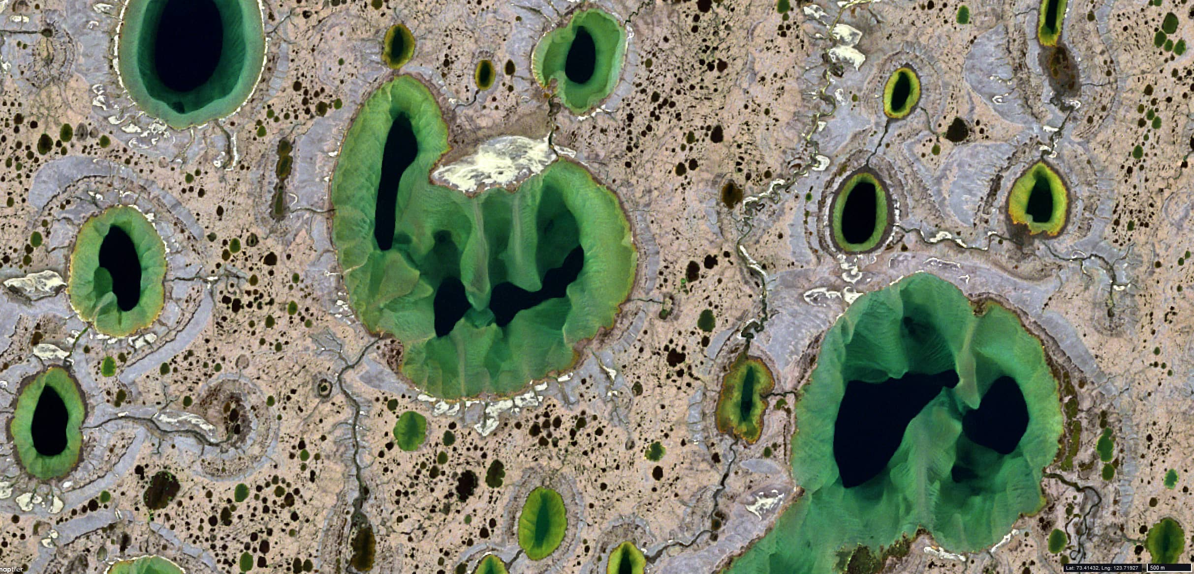
Fig. 6