Husky Lakes Ice Metamorphosis
Northwest Territories | Northern Canada
Dates of acquisition:
- June 11th, 2024 | 21:05:53 UTC
- June 12th, 2024 | 20:36:01 UTC
- June 13th, 2024 | 20:55:52 UTC
Sensor: Sentinel-2 L2A
Coordinates: ca. 68.7°N, 133.1°W
This story is about….
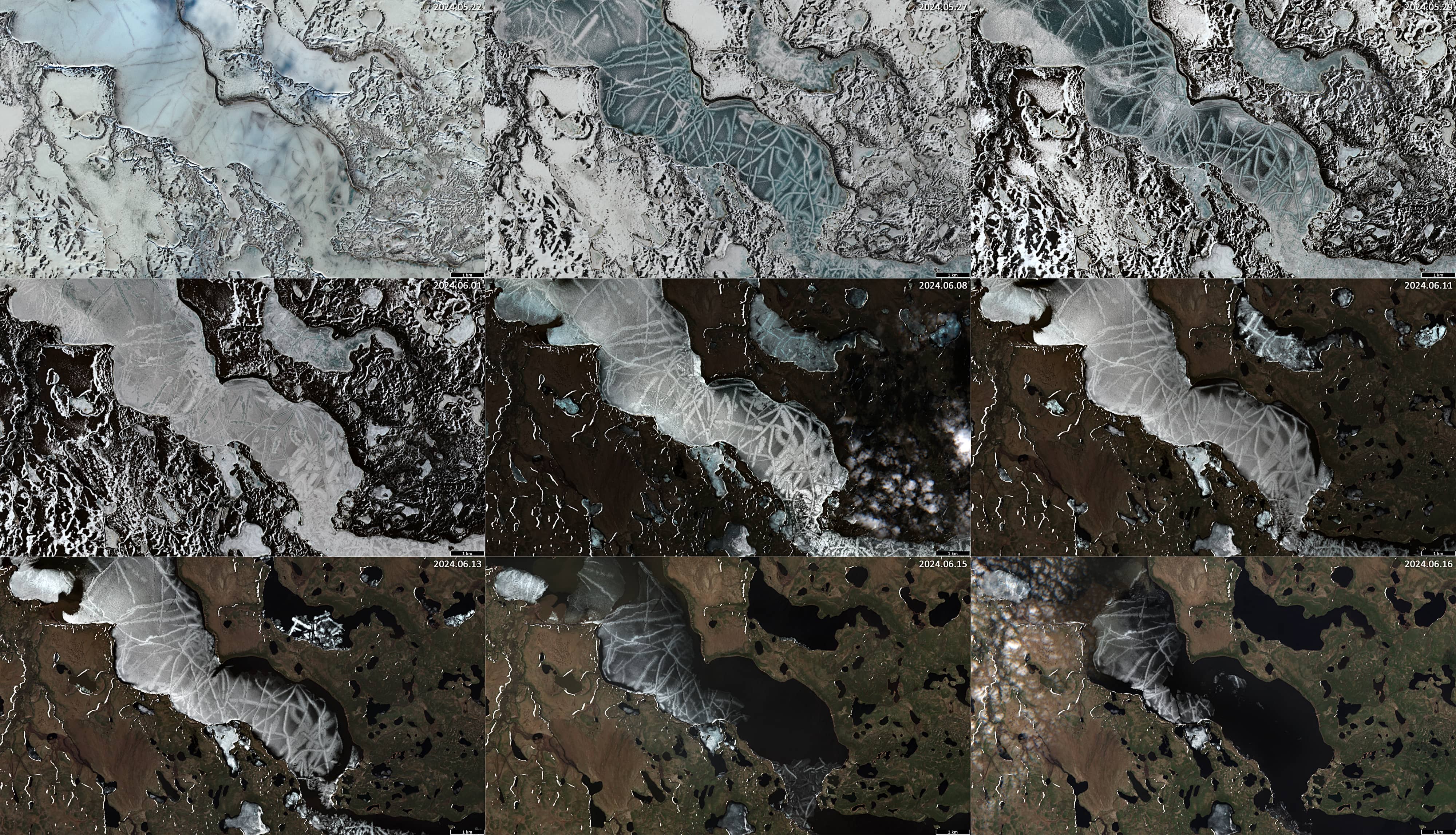
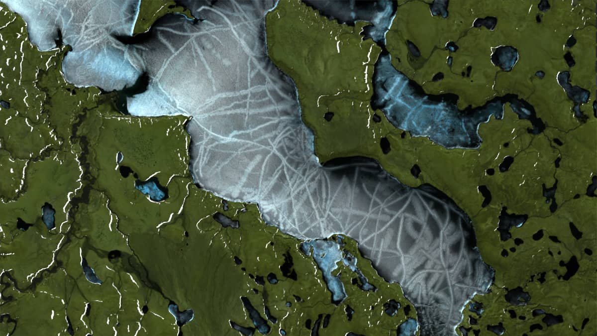
Numerous white, grey and bluish streaks, 0.5–5 km long and 50–200 meters wide (in some cases up to 400 m), that can be observed in June on the drift ice of the Husky Lakes system, Sitidgi Lake, Noell Lake, Jimmy Lake, Parsons Lake and small reservoirs in the area (Figures 1, 2, 3).
Many streaks have a thin, 10–20 m wide “ridge” in the middle that runs the entire length of the streak. There are very many streaks, and they appear to be distributed throughout the entire ice volume, on the surface and inside, connecting, intersecting and intertwining with one another, creating macro-patterns that cover the entire lake ice and extend throughout the ice. It appears thatthe ice is covered with ribbon-like crystalline structures (let’s call them Ribbon-Crystal-Shaped structures – RCS structures).
Over the past 20 years, RCS structures have been detected (with Landsat 7–9 and Sentinel-2 imagery) in 2019, 2016, 2013, 2010, 2008, 2006 and 2004. In other years (when observationswere possible), the ice cover looked different, i.e. without RCS structures.
Where RCS structures are detected, they are found throughout the Husky Lakes region, on numerous lakes and small reservoirs (Figure 1).
Either they are present on hardly any lake in the region, or they are present on almost all lakes. On some lakes the ice melts earlier, on others later, but in any given year, these structures are present almost everywhere in the region.
When the ice has not yet begun to melt and is covered with snow (usually at least until mid-May), structures on the icesurface, especially in the ice layer, are practically invisible in natural colour images. However, when they are present, they are visible on Sentinel-1 radar images throughout the lifetime of the floating ice (Figure 4 – animation). The melting process takes place from mid-May to mid-late June, depending on weather conditions, and usually lasts two to three weeks (Figures 5, 6 – animation, 7 – mosaic).
RCS structures become noticeable in the visible wavelengths (and in the near infra-red ranges) when the ice is freed from snow and becomes transparent (black ice). And they are one of the last remnants of the ice cover (Figures 5, 6 – animation).
What are these bands and stripes and how do they form?
Ice cracks are caused by stresses in the ice sheet. Stresses are mainly caused by temperature changes (which either shrink or expand the ice), wind and waves, currents, the weight of the ice itself (and the snow on top of it), etc.
The pressure of the waves under the ice and the effect of capillarity causes the water to rise along the cracks, taking small air bubbles with it. Air bubbles trapped in frozen waterinside the cracks reflect the entire spectrum of light and give the ice a whitish colour at this place.
Snow sticks to wet ice (forming slush), giving it a whitish colour. Water then drains through the slush. The wet slush strips continue to hold some of the snow and their width increases. Over time and at low temperatures, these strips tend to become quite hard, insulate more due to the presence of air and melt more slowly.
In spring (May-June in this case), the ice is usually thick at first. The temperature changes quite rapidlyduring this time: it is already quite warm during the day and quite cold at night. The expansion and contraction of the ice caused by the temperature changes is quite strong and it is compensated for by the formation of cracks that grow in length. Overnight, the cracks move apart as the ice sheet cools. New ice can often form in them at night. During the day, the cracks close again. As the ice thickens, some of the cracks near the surface of the ice widen a little more.
When the surface of the ice sheet cools, the local ice sheet often takes on a concave shape. As it warms, it contributes to the ice taking on a convex shape. Such changes can result in centrally symmetrical crack structures in the ice that resemble flowers, crystals or geometric shapes. In these cases, it is mainly the upper part of the ice that changes its parameters, while the lower part, close to the water, does not change as much.
As mentioned above, the phenomenon of RCS structures formation in ice is found throughout the entire Mackenzie River delta region. It is also observed in other regions, such as Northeast Asia.
In answering the question of why the years in which this phenomenon is observed are rarer (especially recently) than the years in which it is not, it should be noted that this is a remote region in an extremely sparsely populated part of Canada. Therefore, any theory is not easily tested on the ground. However, we can assume that there is some correlation between the formation of RCS structures and the conditions for ice formation, the thickness of the floating ice cover and possibly the height of the snow cover above the ice. As the thickness of the ice increases, more stresses develop, leading to the formation of more cracks that are filled with oxygenated water. There is therefore a correlation between the formation of RCS structures and the weather and climate conditions in the region.
Fig. 1
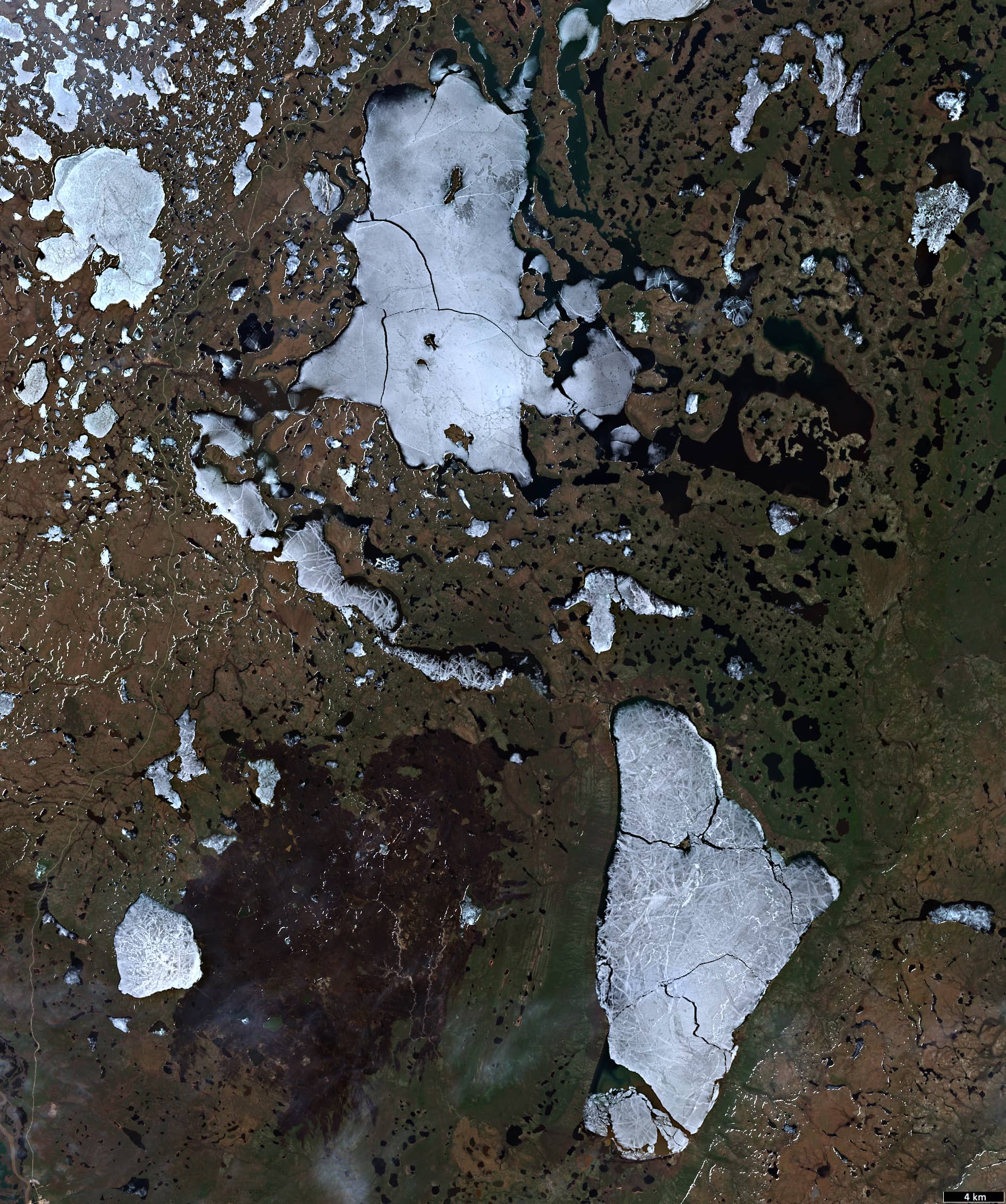
Fig. 2
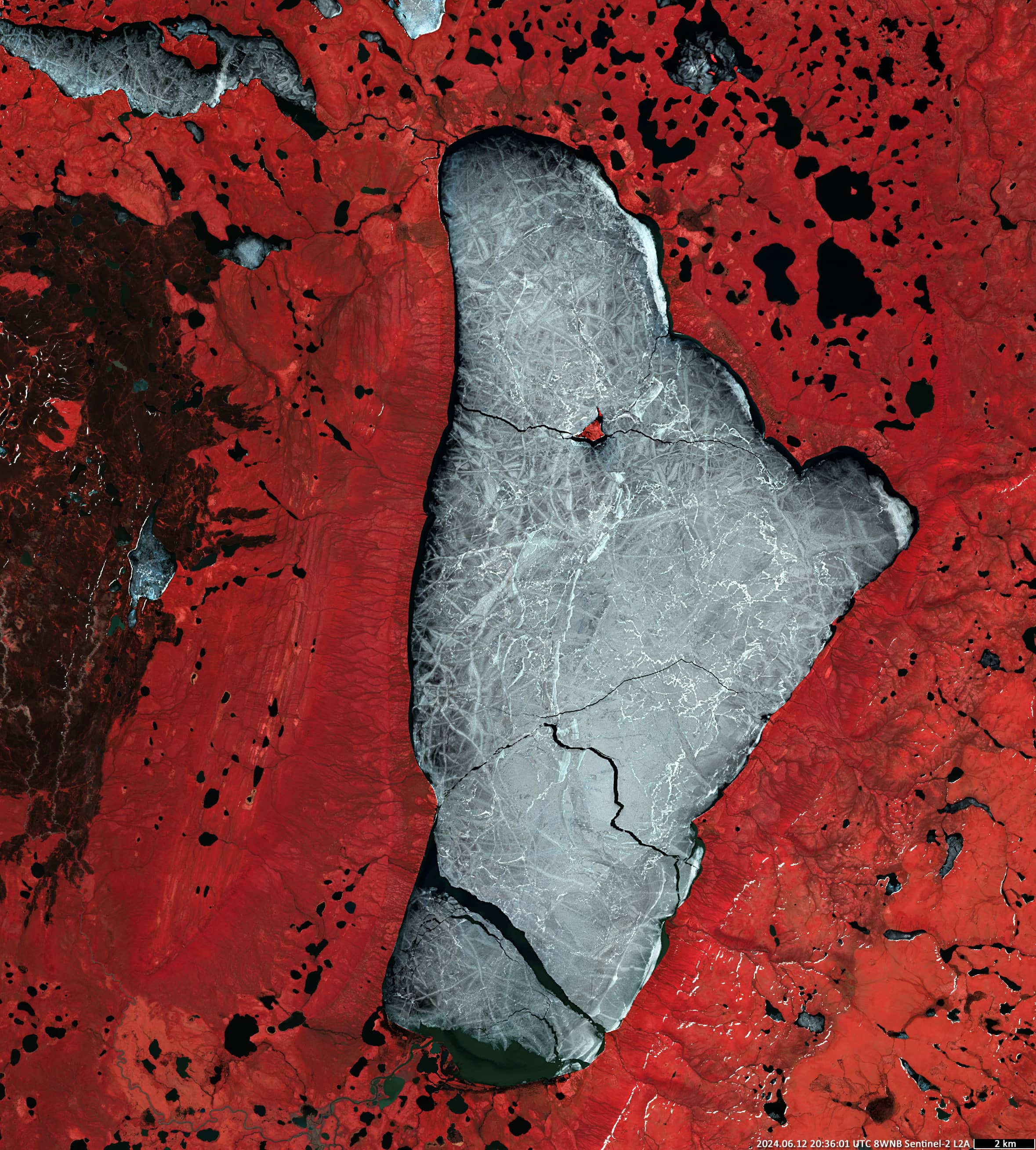
Fig. 3
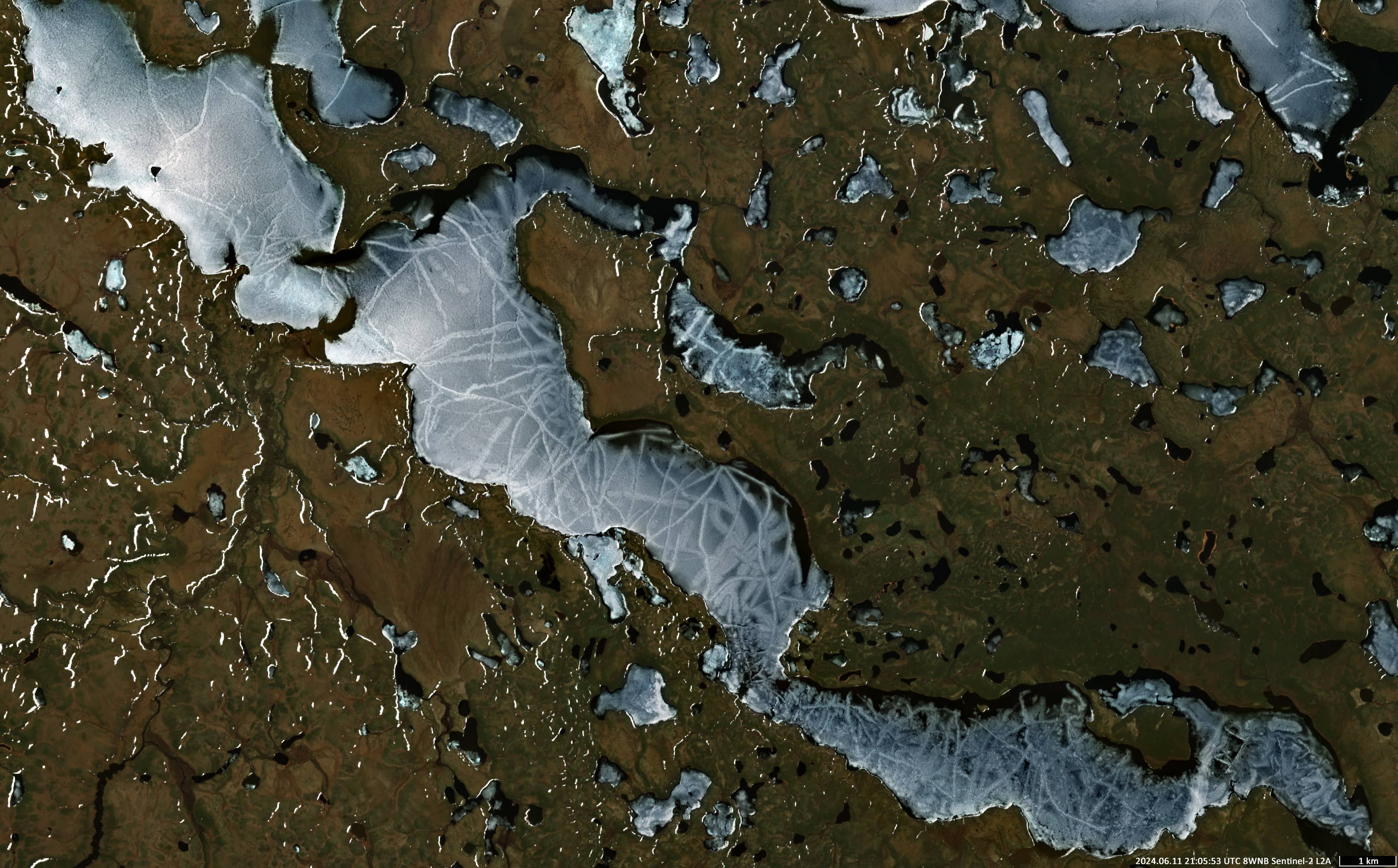
Fig. 4
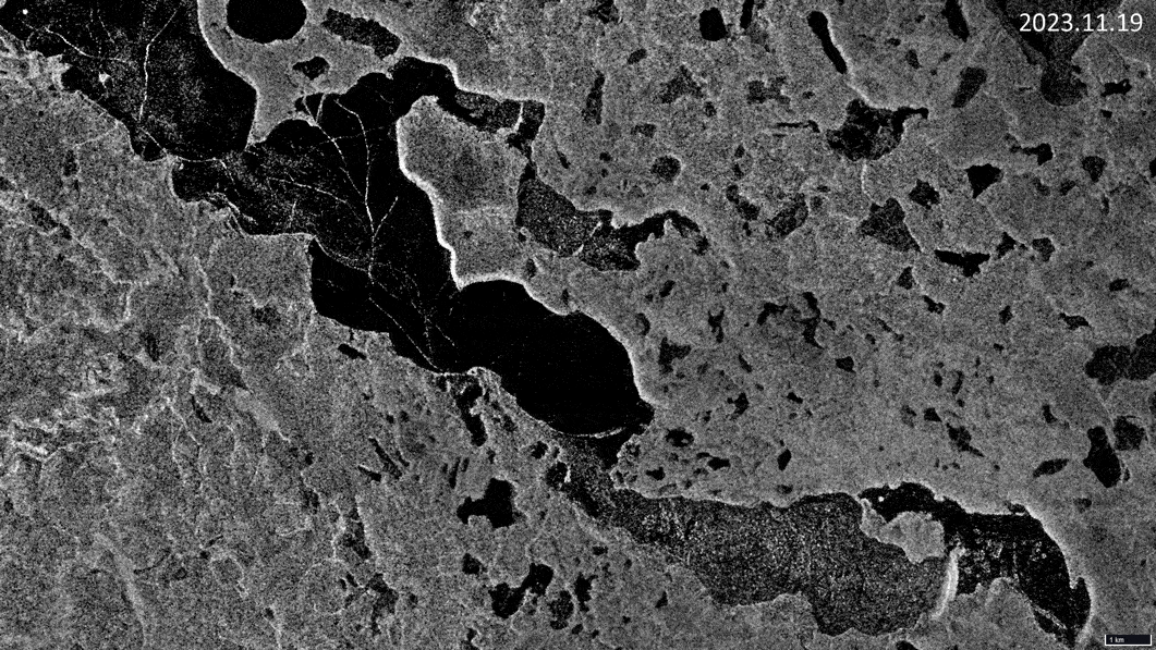
Fig. 5
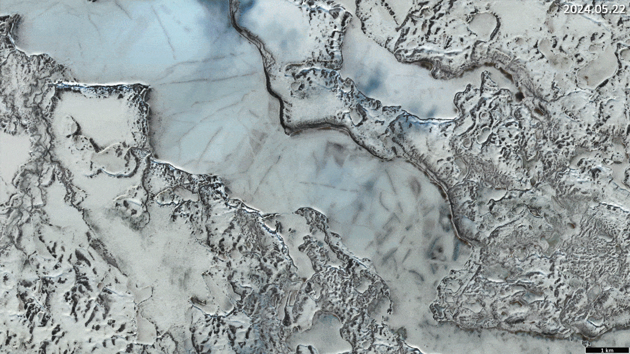
Fig. 6
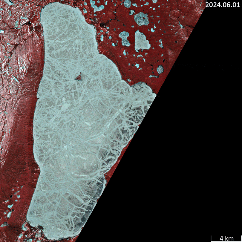
Fig. 7