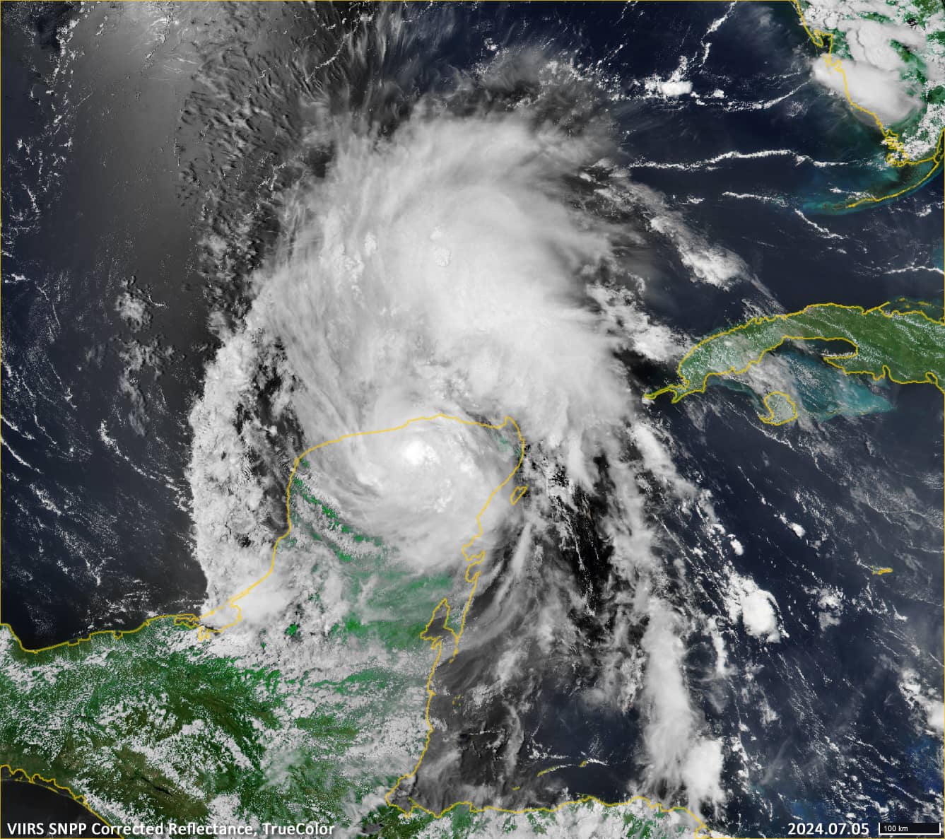
Hurricane Beryl over Yucatan
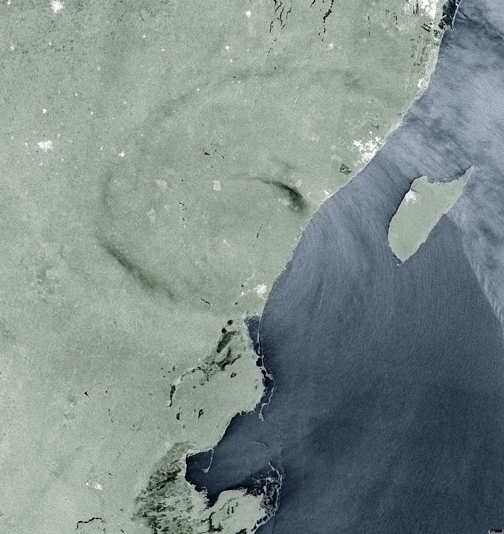
Canal de San Carlos | Gulf of Venezuela
Date of acquisition: July 5th, 2024 | 11:44:56 UTC
Sensor: Sentinel-1 AWS-IW-VVVH, VIIRS SNPP Corrected Reflectance
Coordinates: ca. 20.4°N, 87.5°W
Beryl, the first Atlantic hurricane of 2024, formed as a tropical depression in the mid-Atlantic on 28 June andintensified into a tropical storm on 29 June. In less than 24 hours, the storm quickly became a powerful Category 4 storm. By the morning of 30 June, Beryl’s winds had increased to 105 km/h, making it an “extremely dangerous” Category 4 hurricane. After moving across the Caribbean, Hurricane Beryl made landfall on the Yucatan Peninsula on 5 July, bringing high winds and dangerous storm surges.
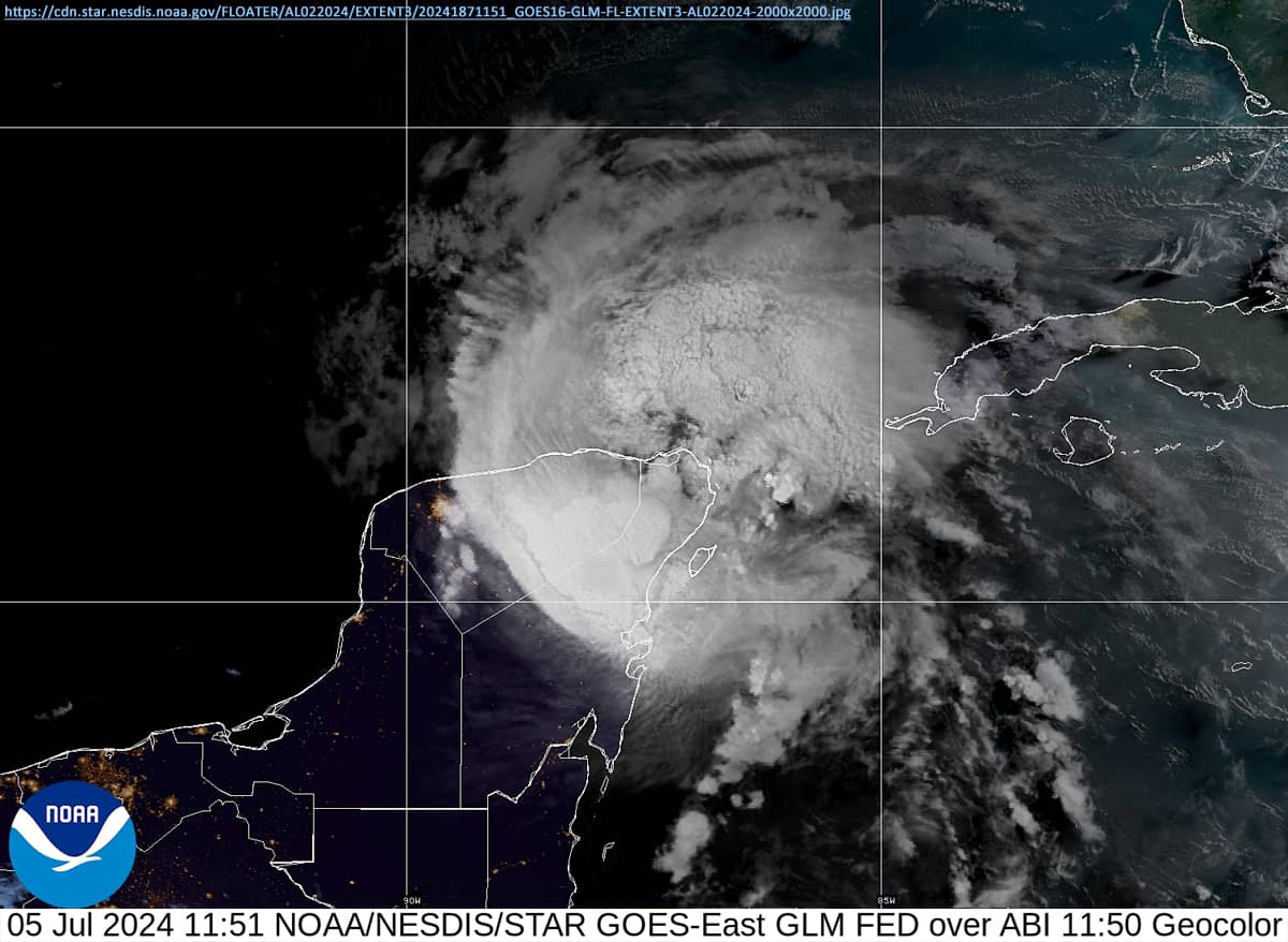
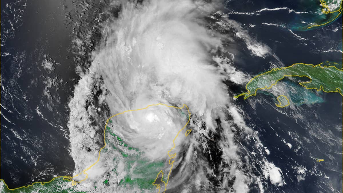
The VIIRS (Figure 1) and the GOES – East (Figure 3) images provide a general picture of the hurricane for this date.
The presented Sentinel-1 satellite radar image (Figure 2), which is the subject of this article, records the moment when the centre of the hurricane was over land, over the municipality of Tulum (approx. 20.37°N, 87.53°W), near Lago el Continente. The Isla Cozumel can be seen to the east.
This is a very rare image, as it is only occasionally possible to capture the effects of hurricanes on the Earth’s surface, especially on the land surface, using Sentinel-1 satellite imagery.
In this case, the direct effects of strong winds on the vegetation cover of the peninsula can be observed.
Yucatan’s vegetation consists mainly of deciduous forests and dry, thorny scrubland. Strong winds can rip the leaves from the trees and bend or even break branches and trunks. Combined with heavy rain, wind gusts make it easier for trees to be uprooted from waterlogged ground.
In any case, it should be noted that the surface texture of the forest under the spiral strip changes mechanically, and affects its reflective properties for the radar.