Eruption of Lewotobi Laki-Laki
Flores Island | Lesser Sunda Islands, Indonesia
Dates of acquisition:
• 2024.11.08 | 02:09:55 UTC
• 2024.11.09 | 01:28:11 UTC
• 2024.11.09 | 14:00:05 UTC
• 2024.11.13 | 02:10:01 UTC
• 2024.11.18 | 02:10:01 UTC
Sensors: Sentinel-2 L1C, Sentinel-3 OLCI, Sentinel-3 SLSTR
Coordinates: ca. 11.05°N, 71.6°W
The Lewotobi volcanic structure in the east of Flores Island (Indonesia) consists of two neighbouring stratovolcanoes: the 1584 m high Lewotobi Laki-Laki in the north and the 1703 m high Lewotobi Perempuan (“husband and wife”) in the south. Their summits are less than 2 km apart.
Current eruptive activity at Lewotobi Laki-Laki has increased since early November. A large explosive eruption on 3 November resulted in pyroclastic flows and caused casualties. Explosions continued on 4 and 5 November.
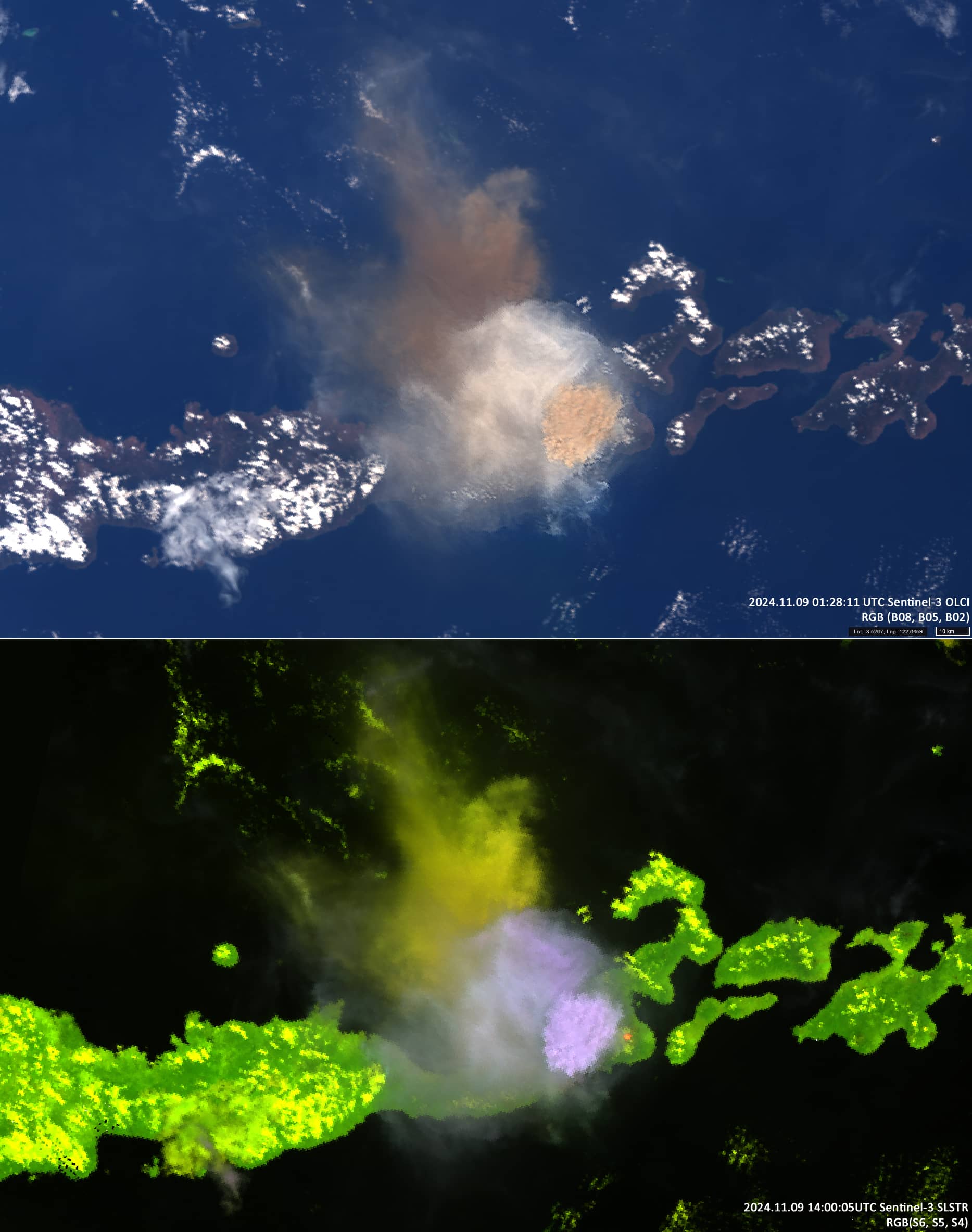
On 8 November at about 20:55 UTC, another eruption began, during which a yellow columnar ash cloud was explosively ejected high into the atmosphere (9 November at around 00:55 UTC). This event was recorded by the Sentinel-3 instruments OLCI and SLSTR (Figure 1). At 03:30 UTC, the yellow ash explosion ended and the eruption stabilized at a constant level.
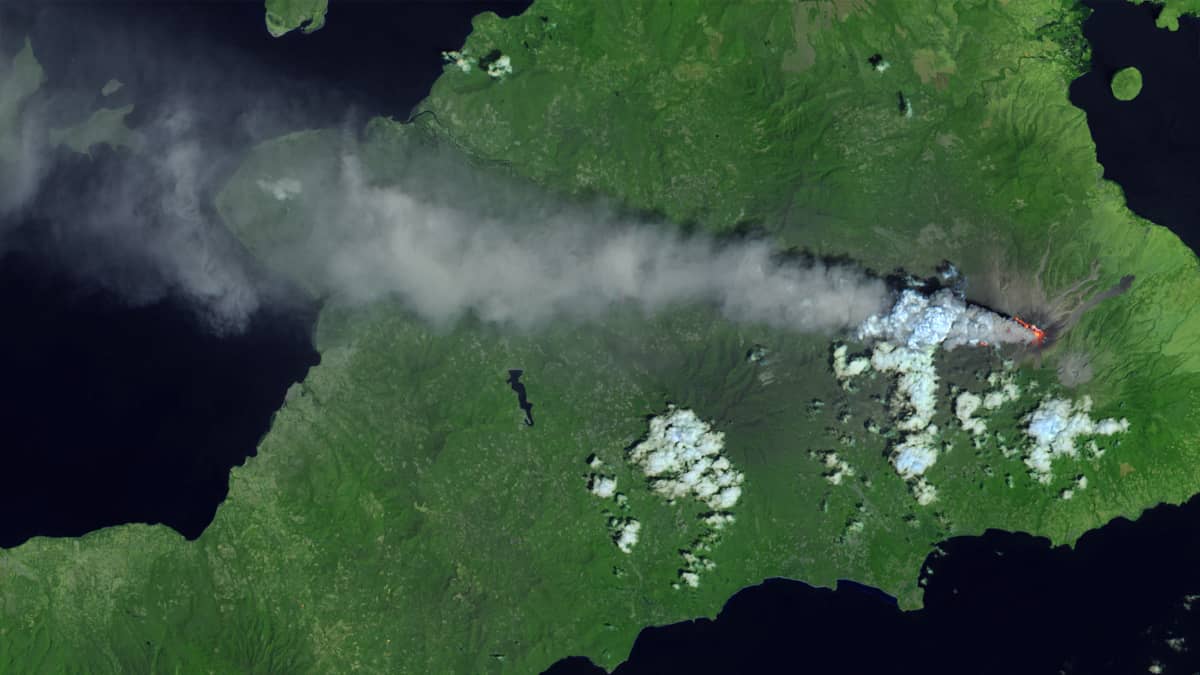
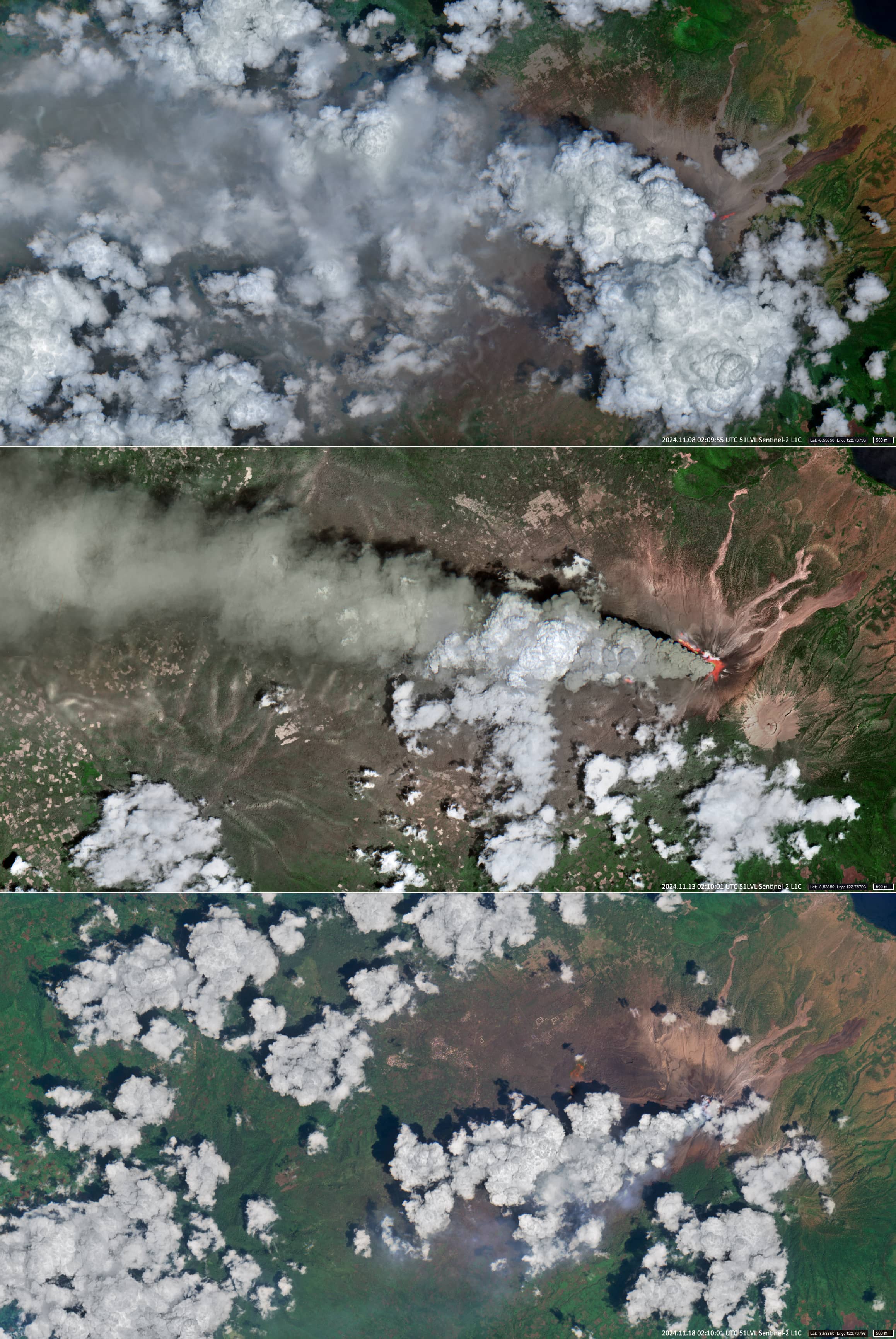
Until 12 November, the eruption at Lewotobi Laki Laki remained at a high level, producing high ash columns, explosions, pyroclastic flows, and lava flows that significantly affecting the population, infrastructure and transport. The eruption lasted until 19 November. White-gray ash clouds rose up to 4.5 km above sea level and moved westwards and northwestwards (Figure 2, color composite of visible and near-infrared bands).
On 23 November the eruption of Levotobi Laki-Laki volcano has not stopped, but has stabilized at a relatively low level.


