Dust Storm over Red Sea
Red Sea Coast | Northeast Africa
Dates of acquisition:
- June 09th, 2024 | 07:32:28 UTC
- June 10th, 2024 | 07:42:10 UTC
- June 11th, 2024 | 07:18:59 UTC
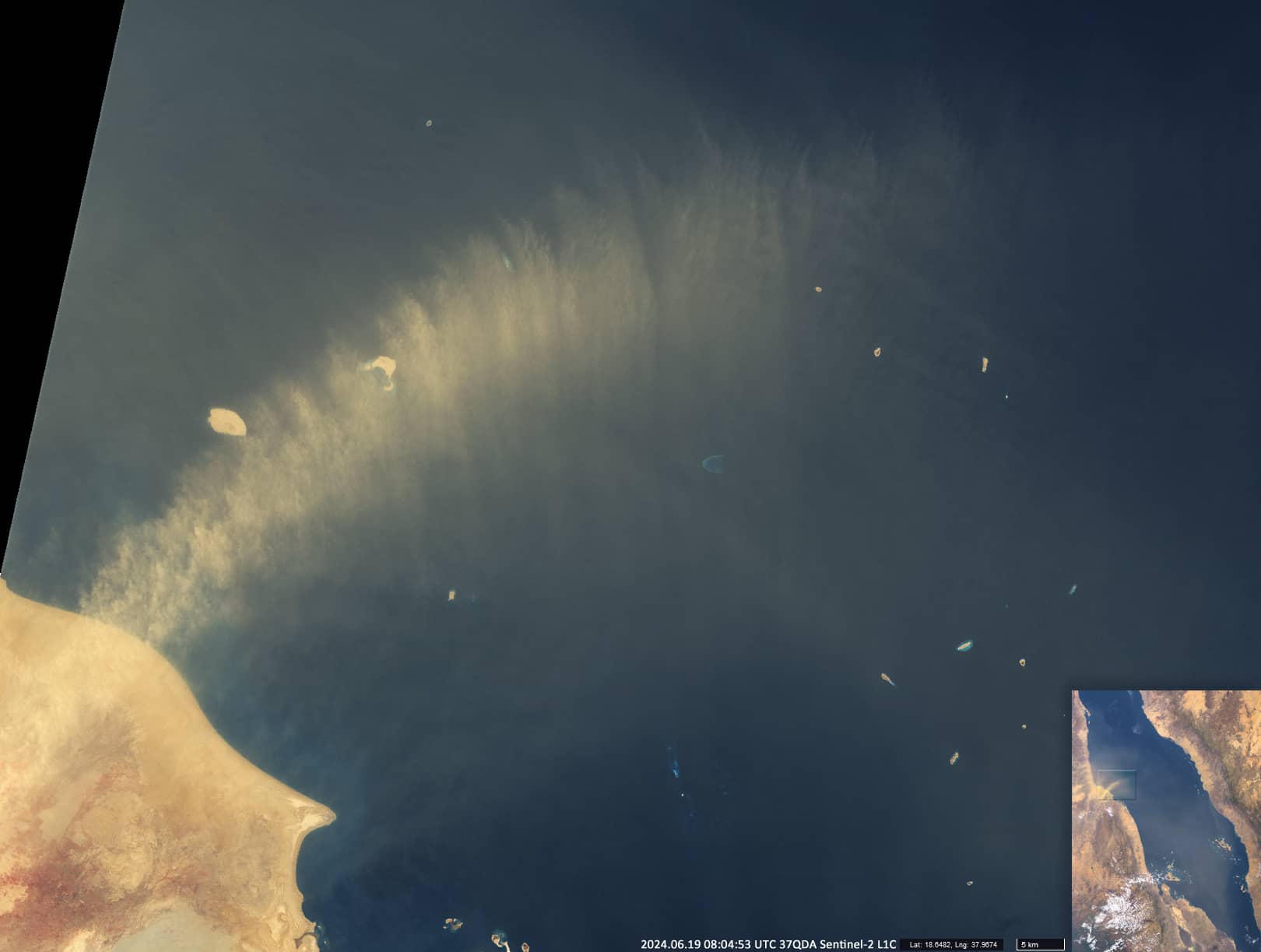
- June 19th, 2024 | 08:04:53 UTC
Sensor: Sentinel-3 OLCI, Sentinel-2 L 1C
Coordinates: ca. 19.1°N, 38.8°E
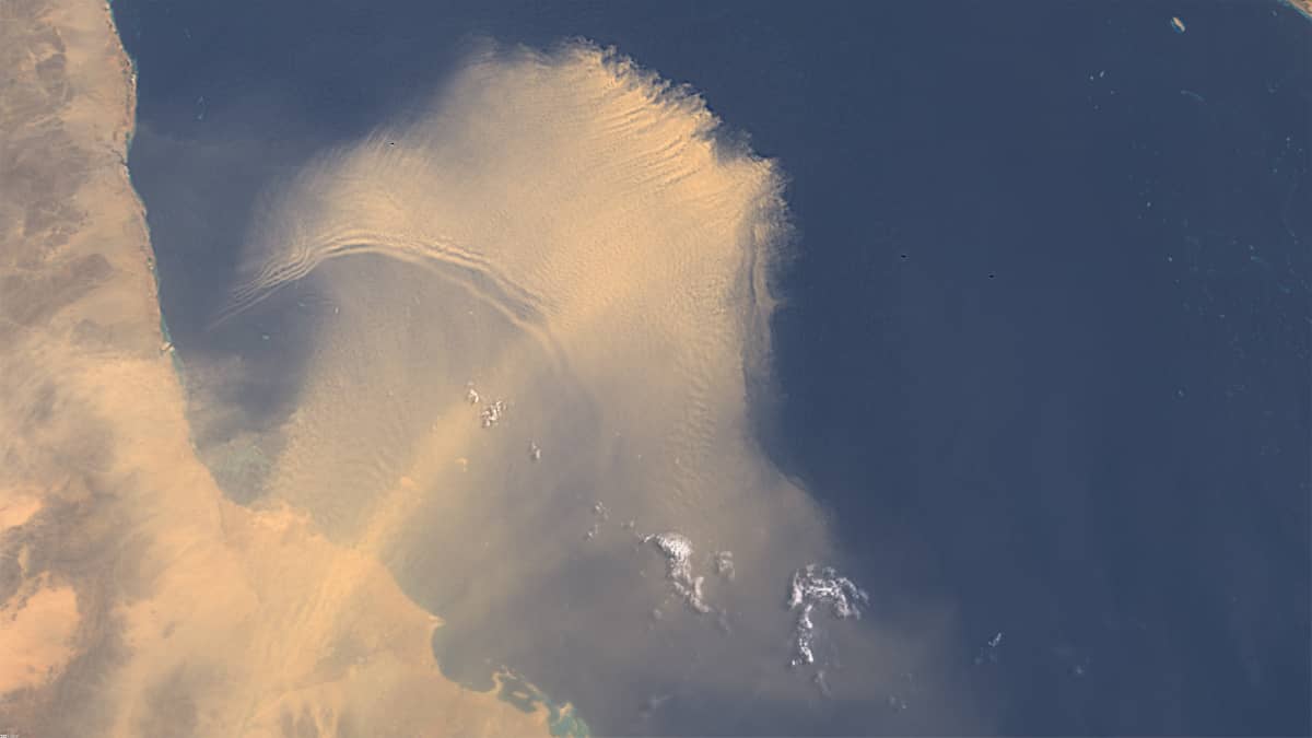
In early June, severe sandstorms were observed in eastern northern Africa and along the Red Sea coast. They reached their maximum intensity in the Red Sea area on 9 to 11 June (Figure 1).
As is often the case, a storm spread across the sea from the Sudanese coast between the Tokar Delta and the Dungonab Peninsula. The Tokar Delta, over 45 kilometres long and 80 kilometres wide, is formed by alluvial deposits from the floods of the Khor Baraka River; the region is considered one of the hottest and driest in the world.
On 11 June, dense clouds of dust covered more than 300,000 km2 – almost the entire southern part of the Red Sea (and part of the coast of the Arabian Peninsula).
Throughout June, the Tokar Delta area remained an almost daily source of aerosolised sand and dust over the southern Red Sea (Figure 2).
Westerly winds from the eastern Sahara dominated the area throughout the month, carrying aerosol from there (Figure 3).