Clouds of southern latitudes
Canal de San Carlos | Gulf of Venezuela
Dates of acquisition:
• 2024.12.14 | 07:20:21 UTC
• 2024.12.25 | 08:37:37 UTC
• 2024.12.31 | 08:36:41 UTC
• 2025.01.04 | 08:10:30 UTC
• 2025.01.05 | 04:25:21 UTC
• 2025.01.11 | 09:34:25 UTC
• 2025.01.25 | 08:30:49 UTC
• 2025.01.27 | 09:13:26 UTC
• 2025.01.28 | 09:35:06 UTC
• 2025.01.30 | 11:25:50 UTC
Sensors: Sentinel-3 OLCI, Sentinel-3 SLSTR
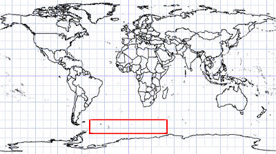
Coordinates: ca. 66°S, 14°E
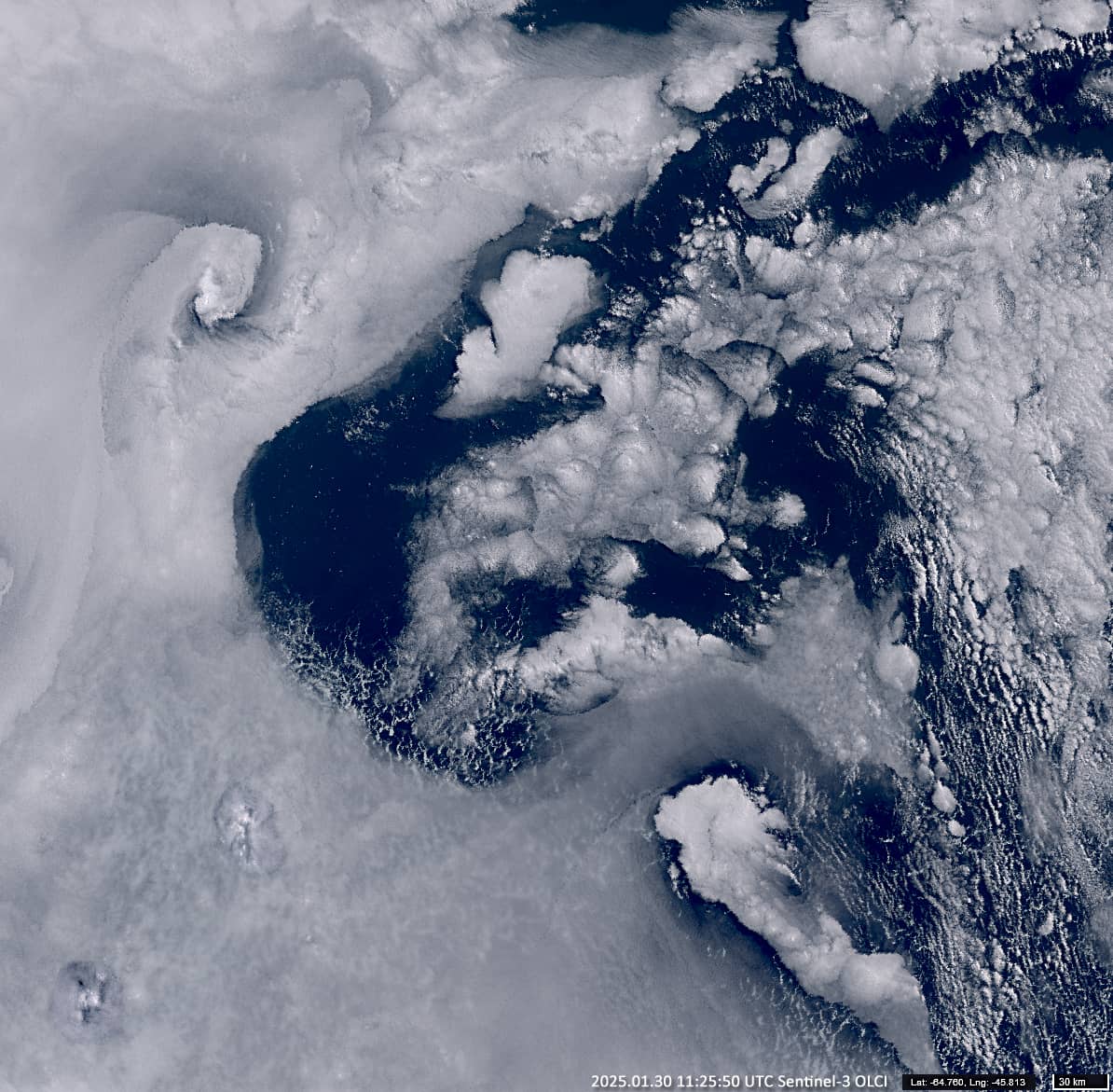
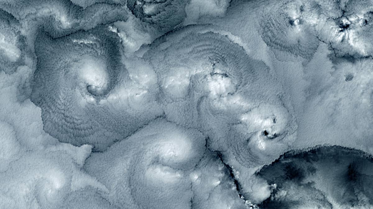
The area where the southern Atlantic Ocean, the south-western Indian Ocean and the Antarctic Circumpolar Current meet is characterised by huge stratus cloud fields and fields of closed Rayleigh convection cells.
Moist and cold air above the ocean waters creates conditions for low clouds, which can contain quite heavy supercooled water droplets. Under the influence of ocean currents with different temperatures and atmospheric phenomena, strong and abrupt horizontal and vertical currents can occur in the air layer at the surface up to 1-2 km. In addition, air convection can occur due to the cooling of the upper parts of the clouds, which radiates heat back into space, creating a temperature gradient between the lower and upper parts of the cloud,. Warm air masses then tend to rise and cold airmasses tend to sink. The result of these processes can be vortices of varying sizes and the formation of various other cloud structures (Figures 1, 4, 5, 8, 10).
Cloud formation examples
When the air cools significantly, supercooled droplets can freeze and crystallise into ice. The ice crystals become heavier, forming more crystals, growing and sinking to fall as snow. An expanding “gap” is formed in the cloud, with a cold, high albedo ice “core” usually at its centre (Figures 2, 3, 6, 7, 8, 9, 10).
Sharp, often arc-shaped field boundaries at different levels of the stratus cloud can in turn be caused by high amplitude low-frequency waves of large in layers of air with different temperatures and humidity. This can occur, for example, when there is an inversion layer of warmer air above colder air. Vertical displacement or separation of one air mass from another can then occur, creating conditions for clouds to disperse or fall as precipitation (Figures 4, 5, 6, 7, 8, 10).
These cloud structures only “live” for a few hours and then collapse. They are more common in this region than in others – almost every day – and are by no means rare.
These structures can sometimes look like strange creatures or figures.
We show some images of the cloud structures mentioned above, taken over the area during the period from December 2024 to January 2025.
Fig. 1
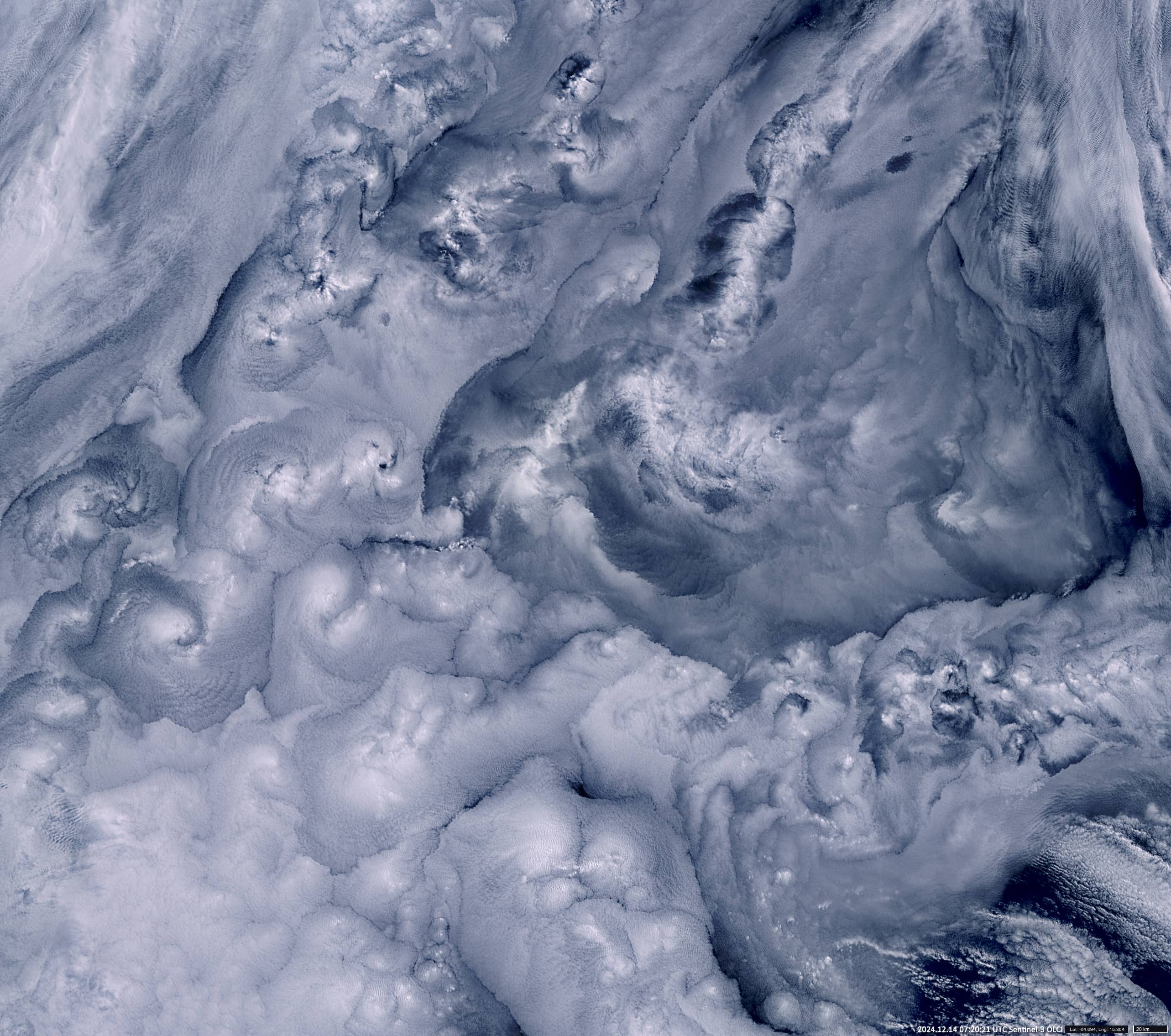
Fig. 2
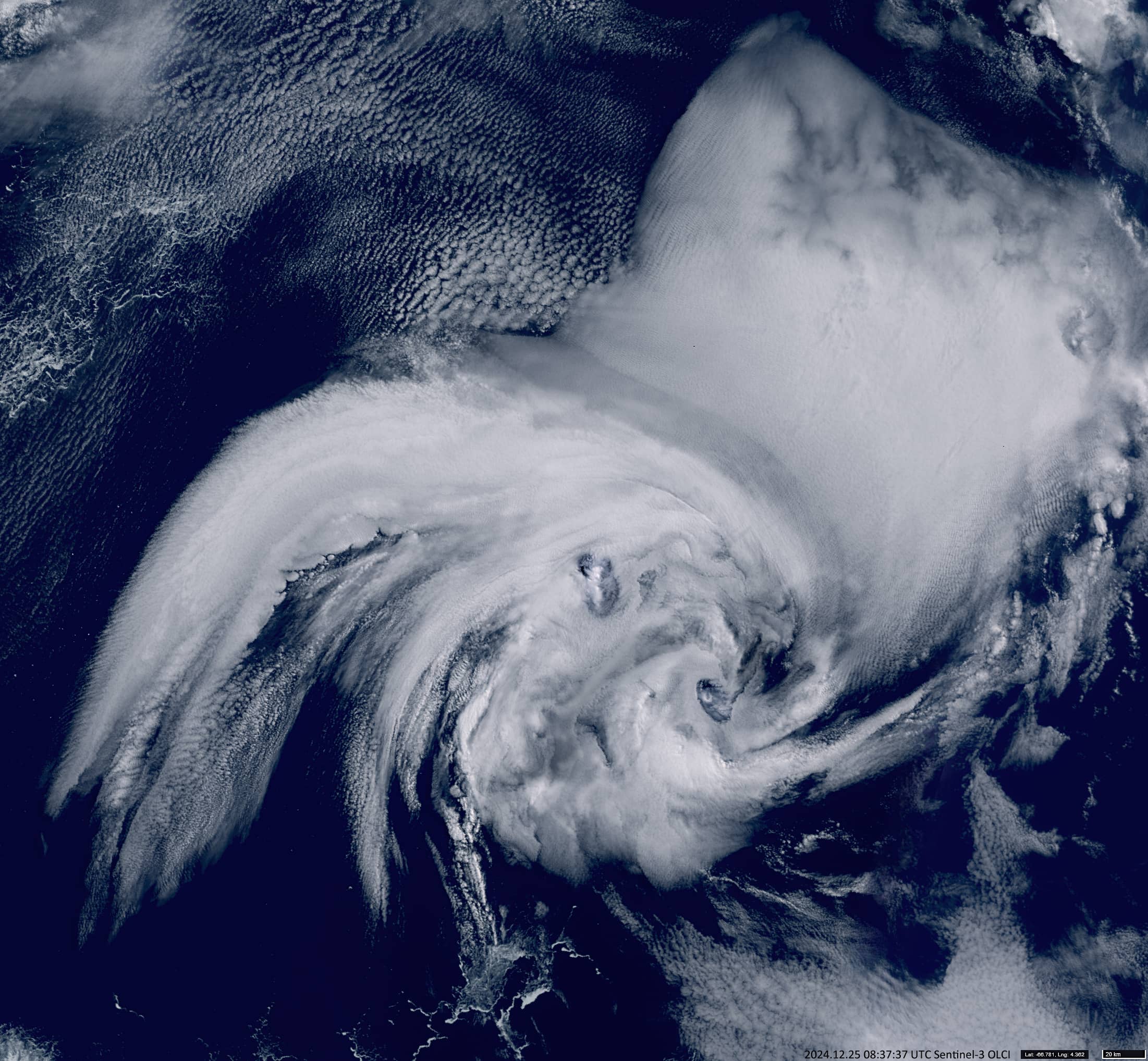
Fig. 3
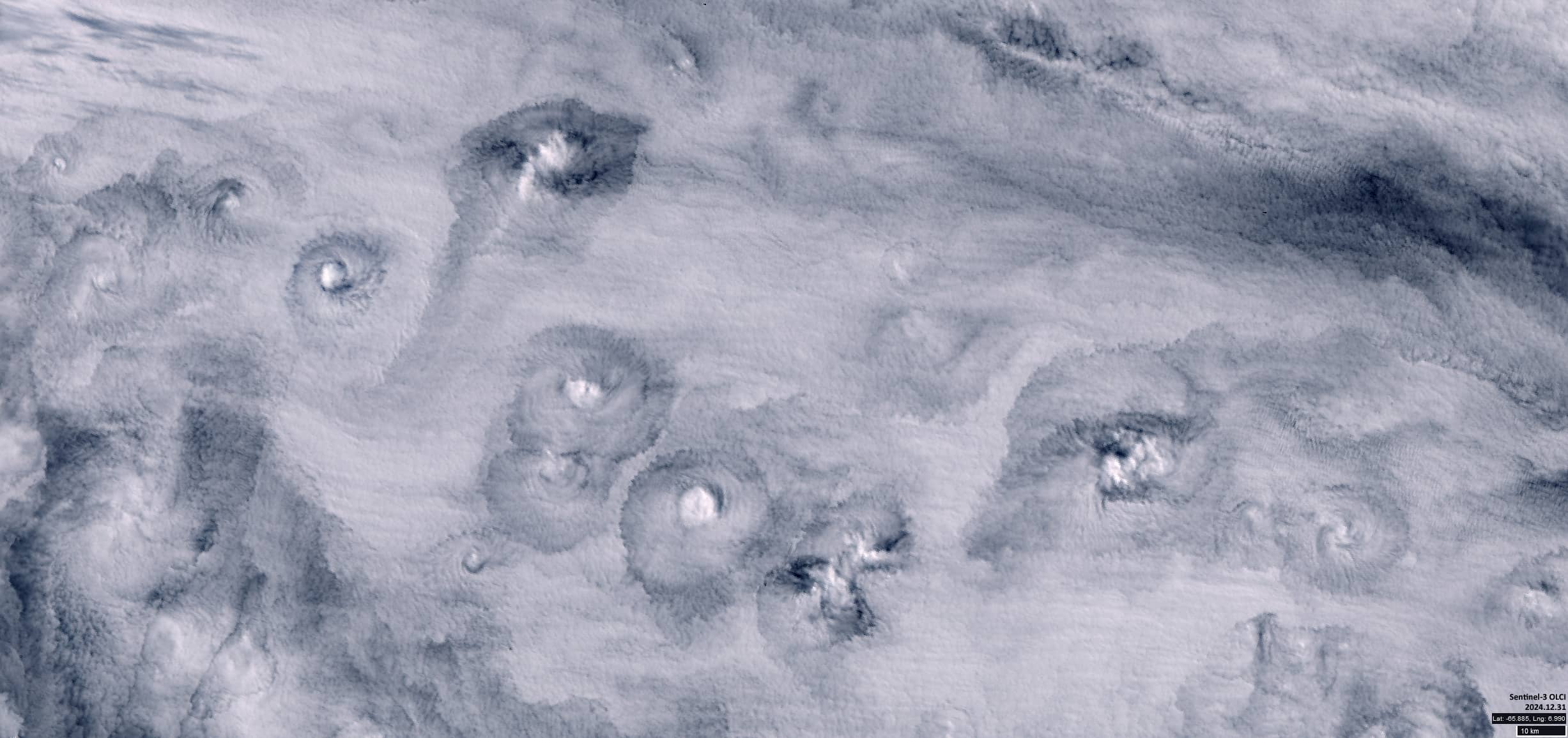
Fig. 4
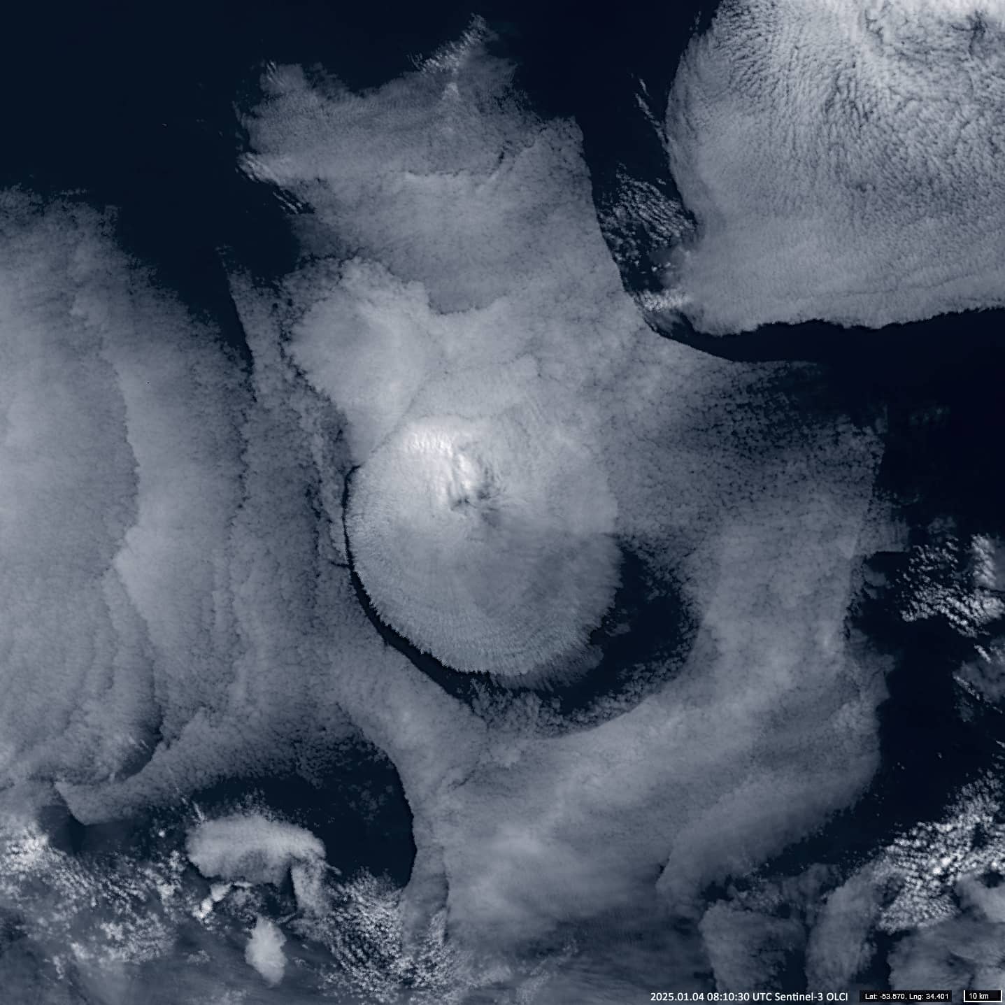
Fig. 5
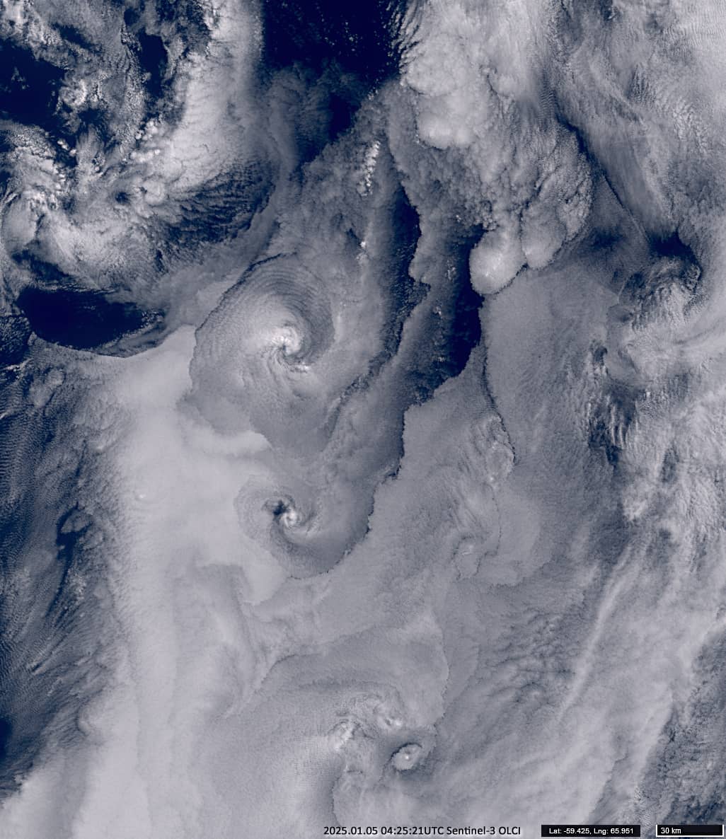
Fig. 6
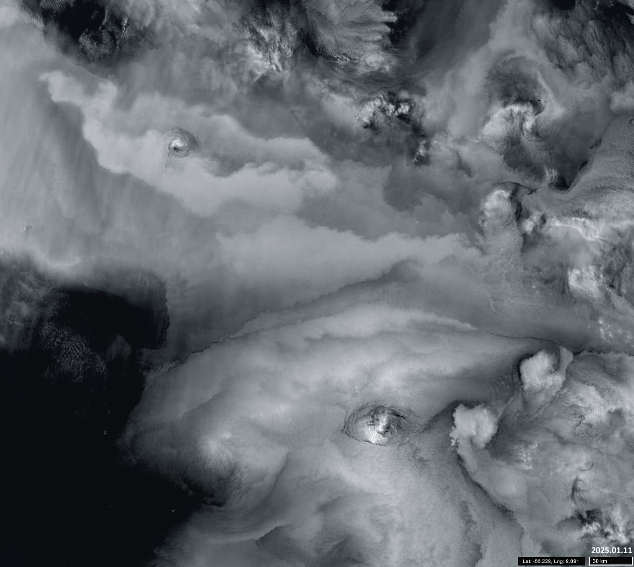
Fig. 7
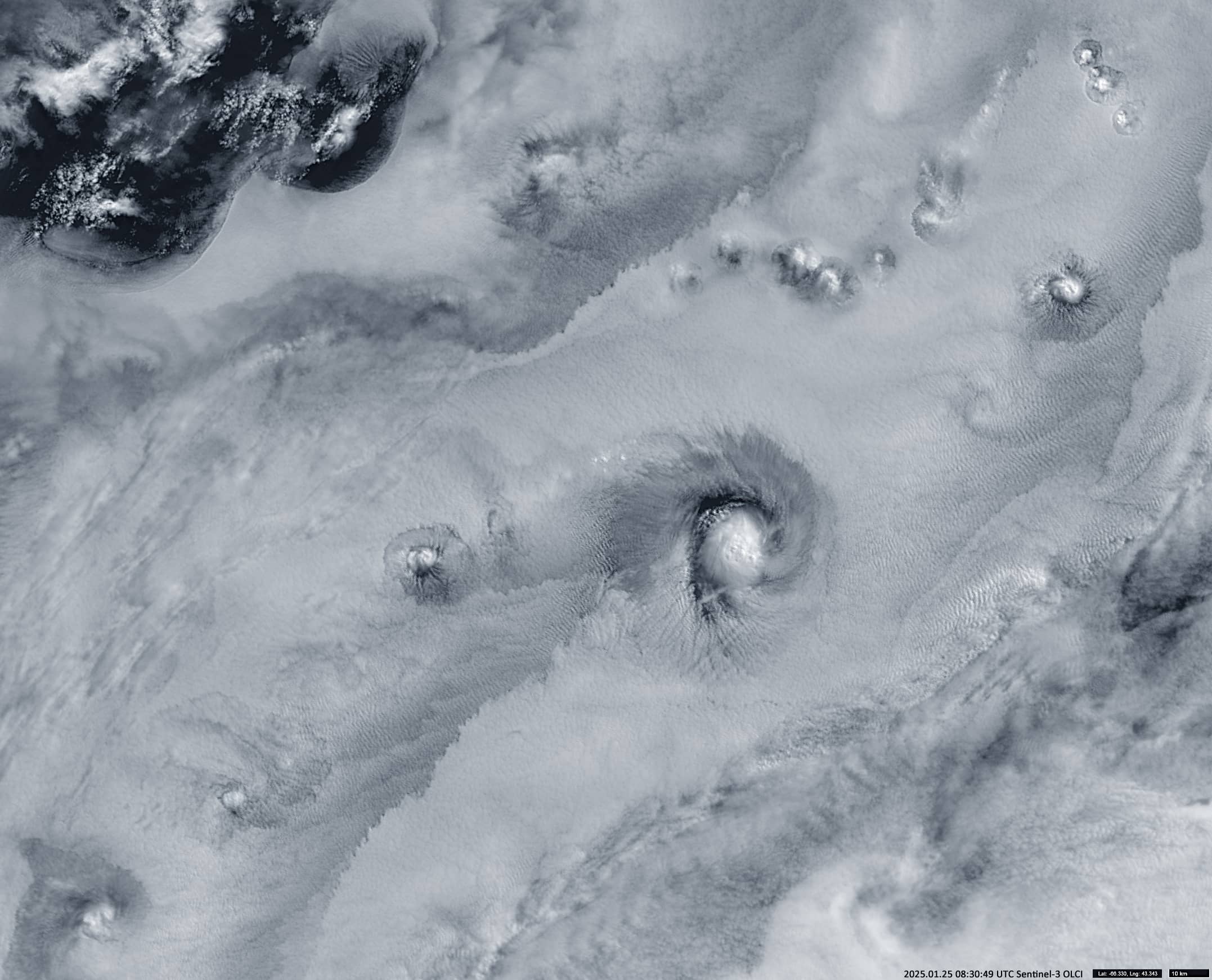
Fig. 8
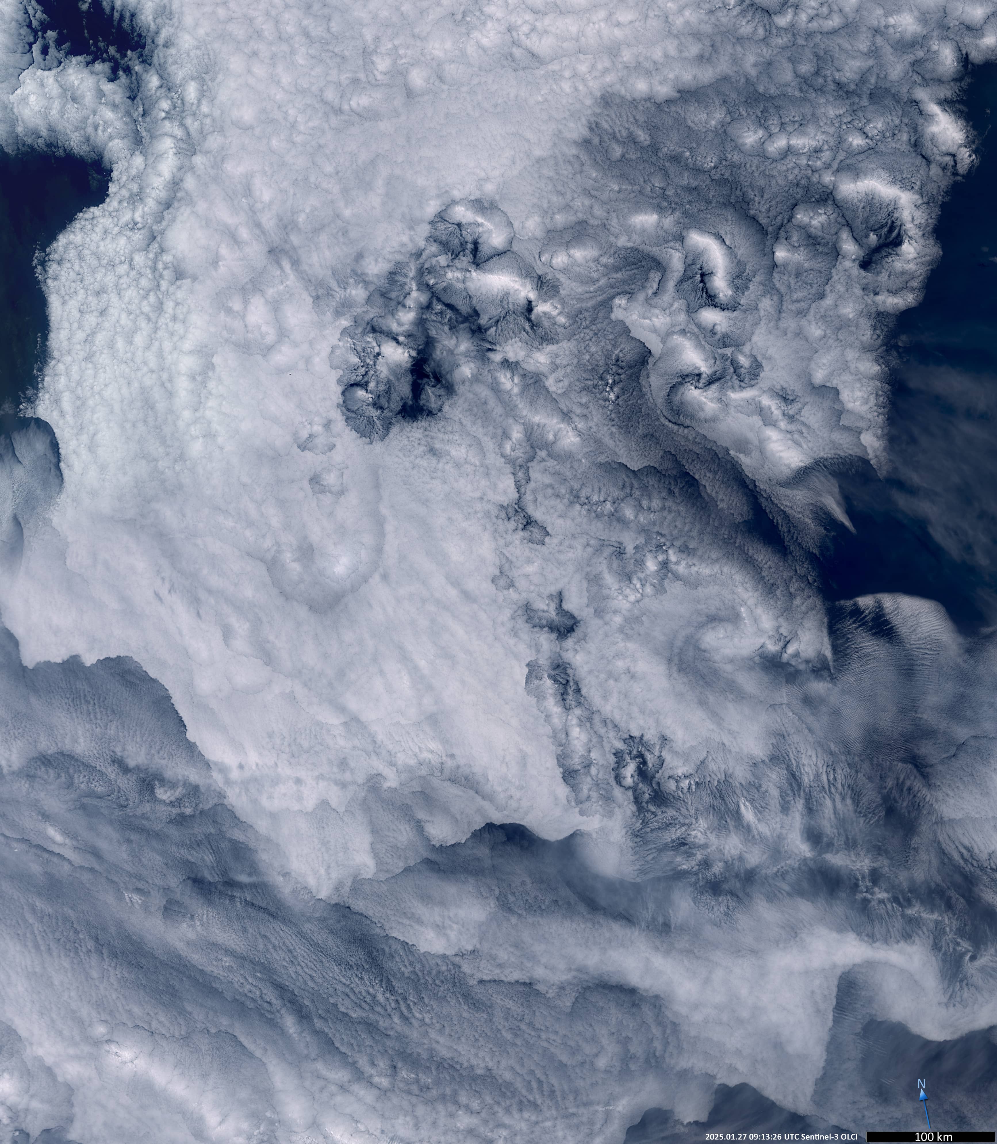
Fig. 9
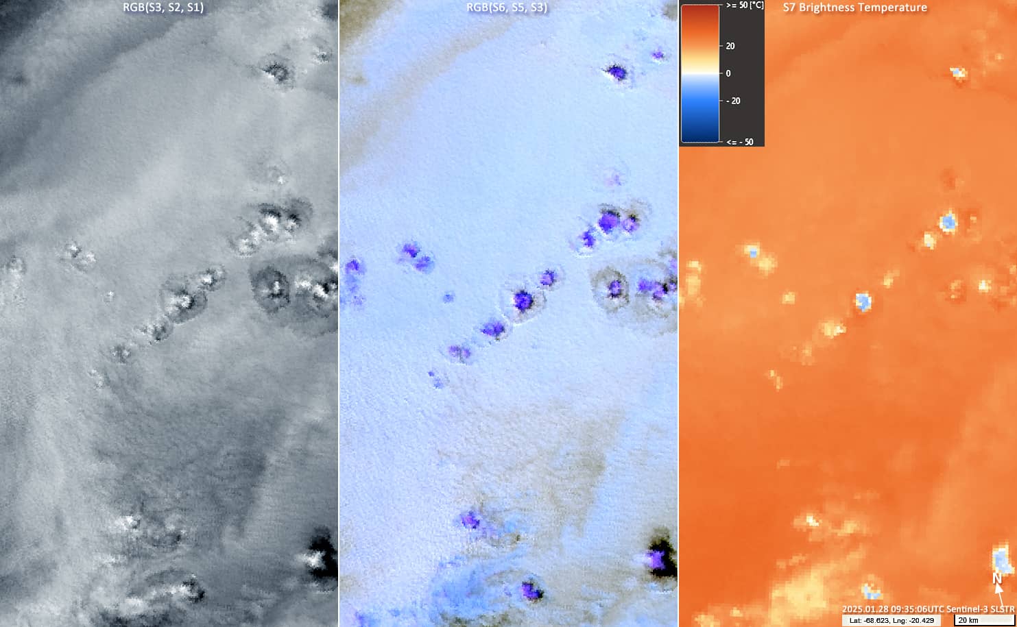
Fig. 10