Clouds in false colors
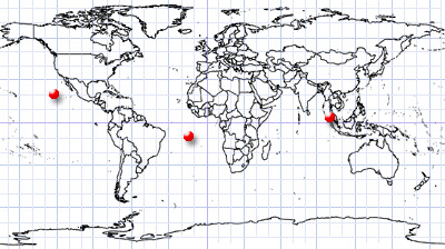
Pacific Ocean west of Mexico, Ascension Island, Strait of Malakka
Dates of acquisition:
- 8th August 2024 | 18:20:18 UTC
- 3rd August 2024 | 03:57:28 UTC
- 8th August 2024 | 10:43:06 UTC
Sensors: Sentinel-2 L2A, Sentinel-3 SLSTR
Coordinates: ca. 8°S, 14.3°W, 4°N, 99.8°E, 21.4°N, 123.3°W
RGB color spaces are a good way to describe the creation of colour images on computer monitors. RGB reproducescolours using an array of red, green, and blue backlit liquid crystals, or other special materials. The human eye contains three types of color-sensitive cells. Each cell responds to light of long, medium, or short wavelengths, usually categorised as red, green, and blue.
Sensors on satellites can capture images of the Earth by measuring the energy of reflected light in different parts of the electromagnetic spectrum. The visualization of a satellite image on computer monitors typically utilises the red, green, and blue wavelength channels to create an image of the Earth as it would be seen by the human eye from space. This combination of colors is usually called a true color composite.
However, when other wavelengths are used instead of (or together with) the specified ones, additional information can be obtained by visualizing data that cannot be perceived by our eyes. In remote sensing, the near-infrared range is of particular interest. Such color combinations are commonly referred to as false color composites.
In the images of different types of cloud structures presented here, taken by the Sentinel-2 and Sentinel-3 SLSTR satellites, such composites can qualitatively show the separation of different layers or cloud structures by brightness temperature which is indicating the height of the clouds. Aside of additional information that can be made visible, such images also have a certain aesthetic value.
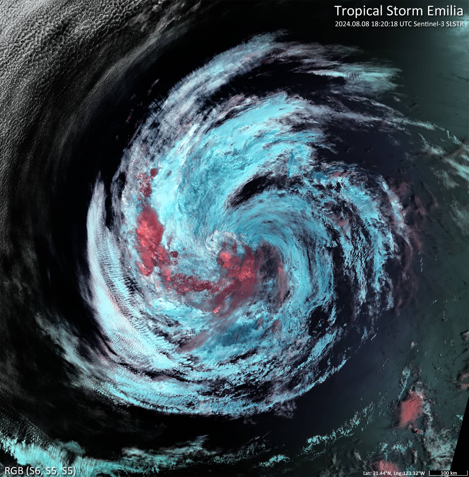
Figure 1 shows a cloud group (coloured brown-red) above the main cloud mass of Tropical Storm Emilia (East Pacific).
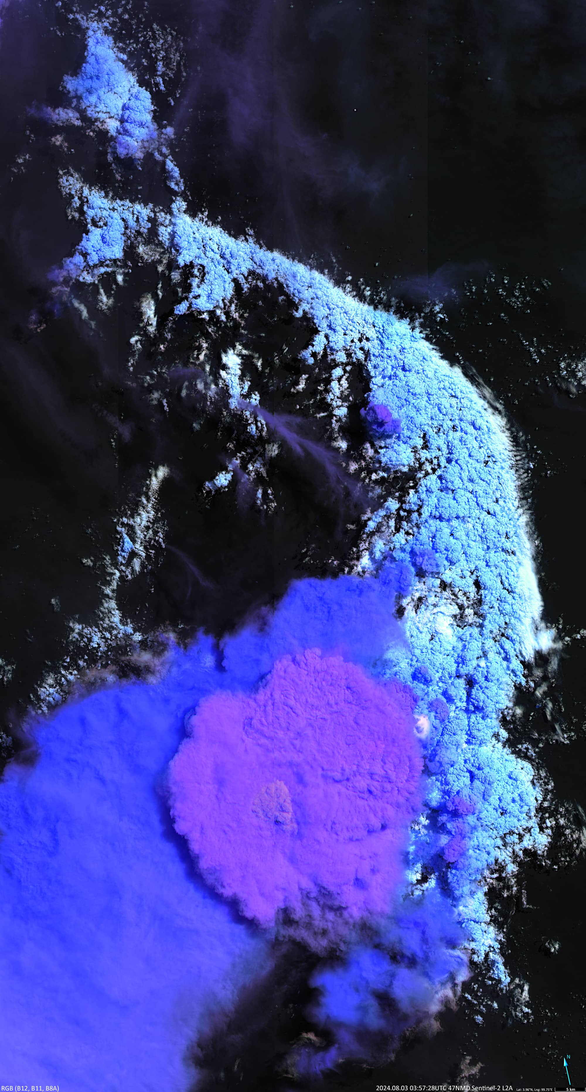
Figure 2 shows the outer boundary cloud structure (white and light blue) and a slightly higher mesoscale convective cloud system (dark blue) overlain by a large (∅ ≈ 40 km) cumulonimbus cloud (dark pink).
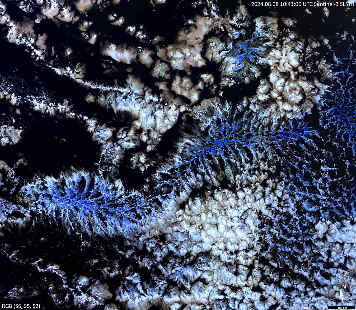
Figure 3 shows an “actinoform” cloud formed by open convection cells. The colouring indicates that the top of the structure is slightly above the upper surface of the surrounding clouds (and its temperature is slightly lower).