Aftereffects of wildfires in Transbaikalia
Eastern Siberia
Dates of acquisition:
- June 08th, 2024 | 03:22:50 UTC
- July 08th, 2024 | 03:22:50 UTC
- July 10th, 2024 | 02:52:34 UTC
- August 19th, 2024 | 03:12:17 UTC
- August 27th, 2024 | 03:22:48 UTC
Sensors: Sentinel-2 L1C, Sentinel-2 2A, Sentinel-3 OLCI
Coordinates: ca. 55°N, 120°E
From June to mid-July, severe wildfires occurred in Transbaikalia (Eastern Siberia). Sporadic fires continued until early August.
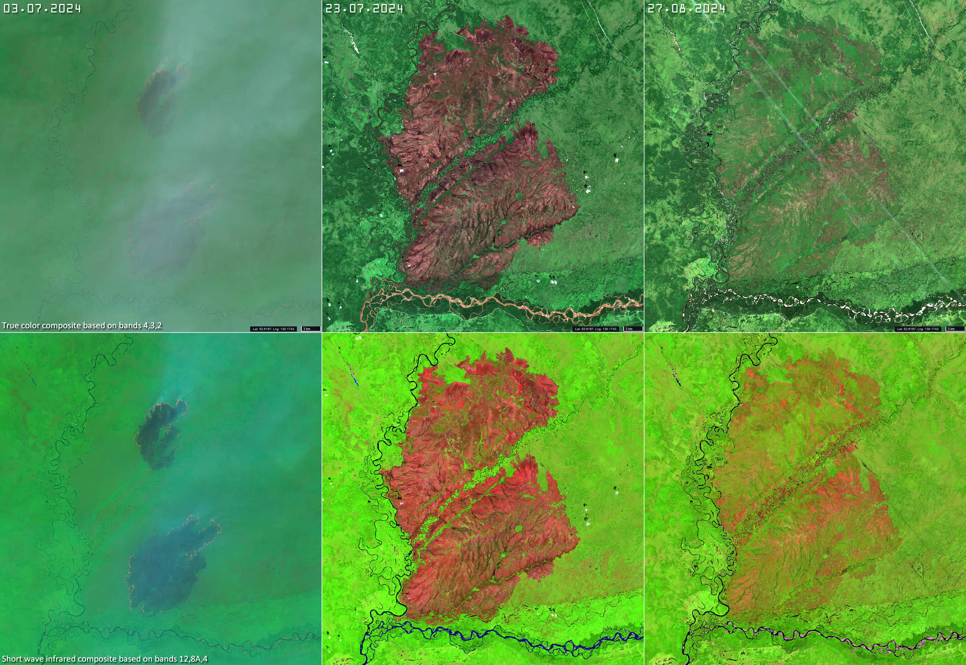
The Sentinel-3 OLCI image (Figure 1), displayed in the near infrared RGB (8, 4, 3) false colour palette clearly shows smoke from numerous fires (yellow) and burnt areas (black) surrounded by vegetation (red). Figures 2, 3 and 4 show the fires and the burnt areas after the end of the wildfire.
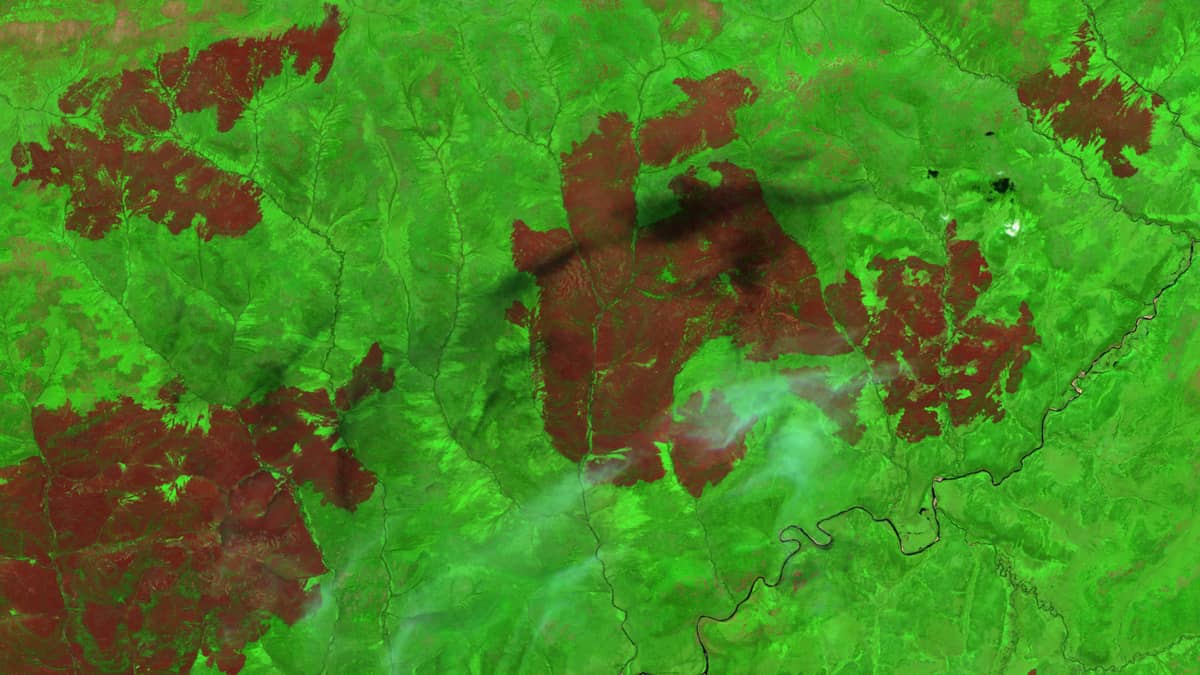
The burnt areas are especially visible when the SWIR range is used in the RGB (which is the actual subject of this report), where they are highlighted in reddish brown, while the vegetation unaffected by the fire is green. The mosaic (minimizing the amount of clouds) created during the second half of August in the near infrared SWIR RGB shows the traces and consequences of dozens of wildfires over a huge area of about 500 000 km2 (Figure 5).
The Zeya Reservoir is visible in the eastern part of the image.
In some flat areas and hills, the vegetation takes a year or two to start again, while in other areas, the ground is covered with vegetation as first stage of succession that have sprouted from seeds just a few weeks after the fire (Figure 6).
Fig. 1
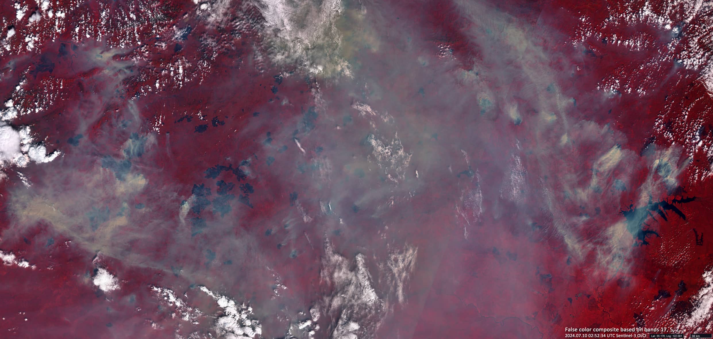
Fig. 2
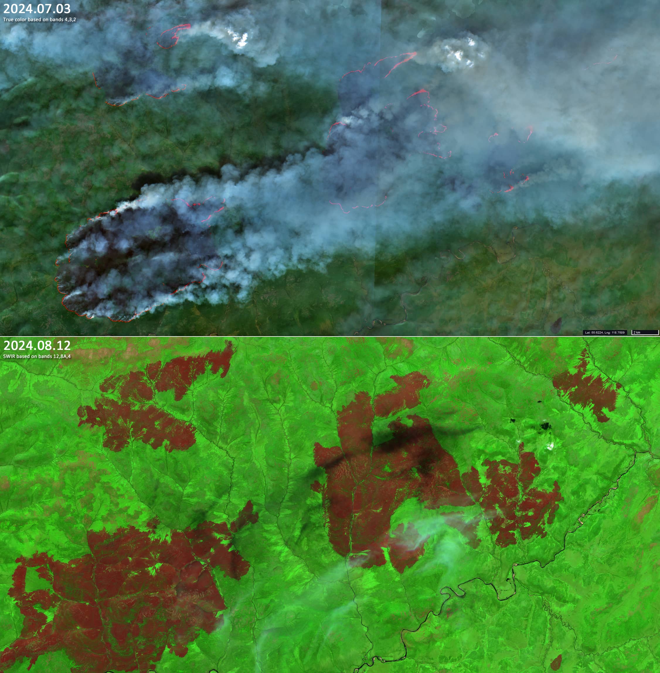
Fig. 3
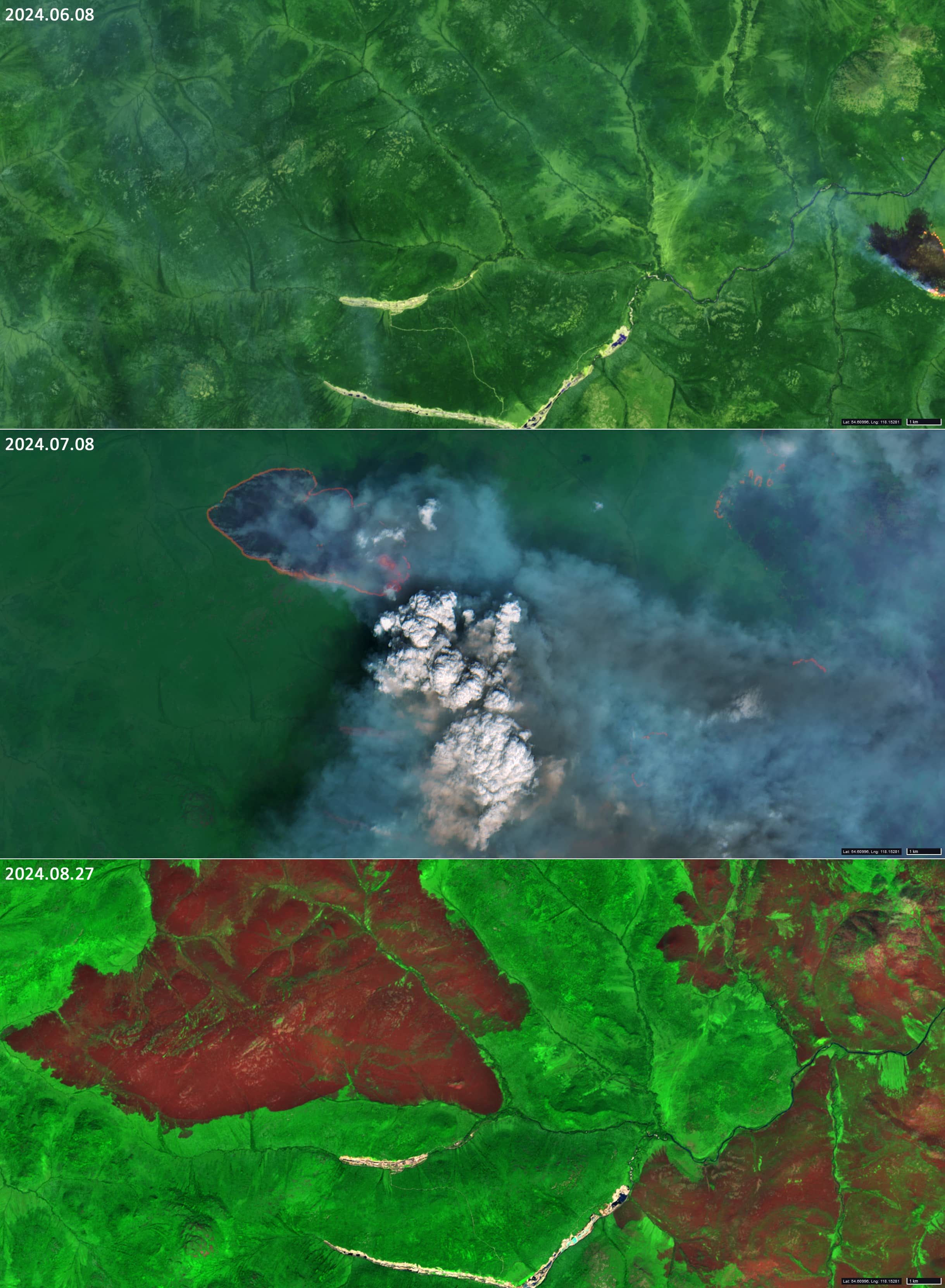
Fig. 4
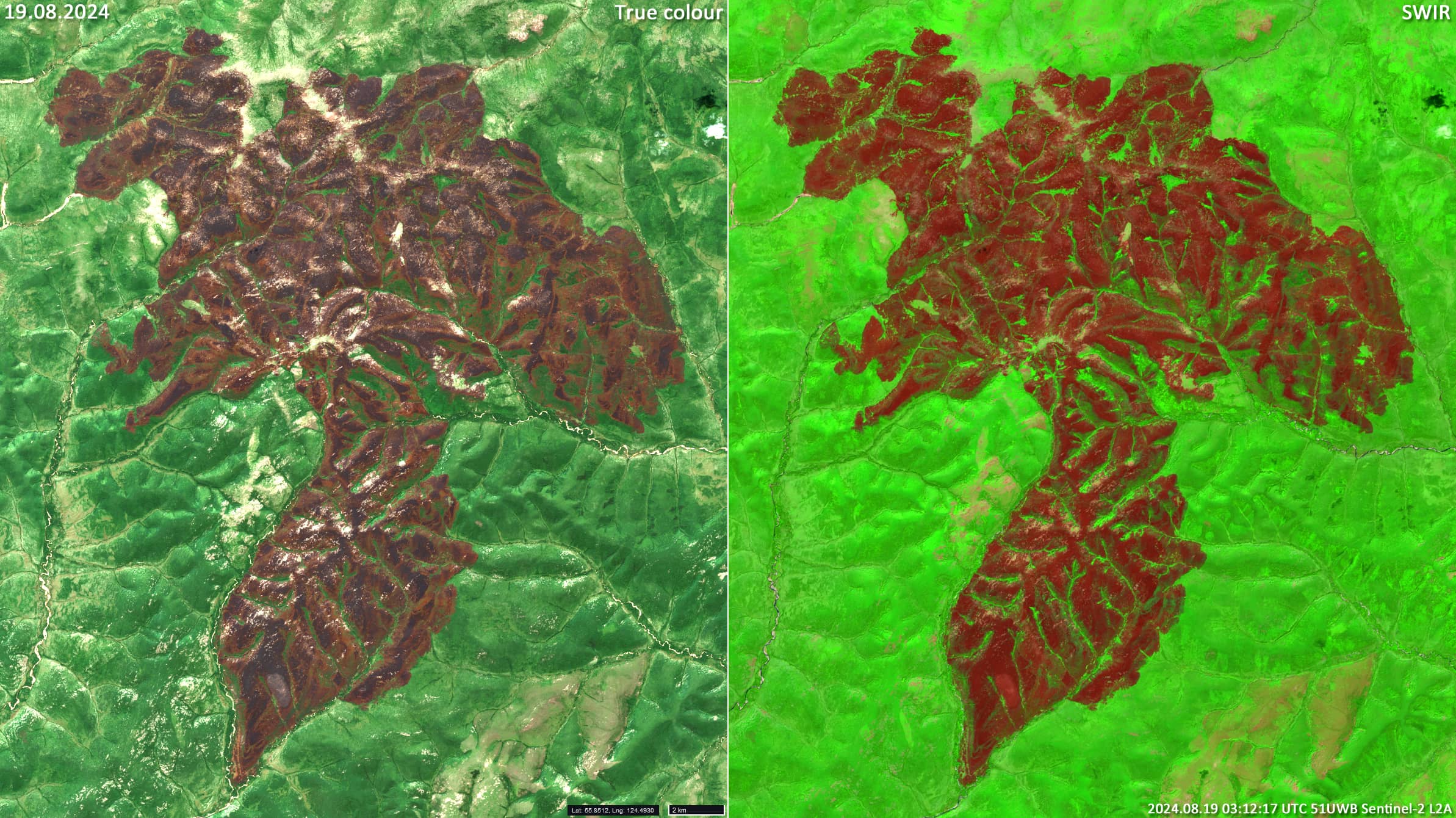
Fig. 5
Fig. 6