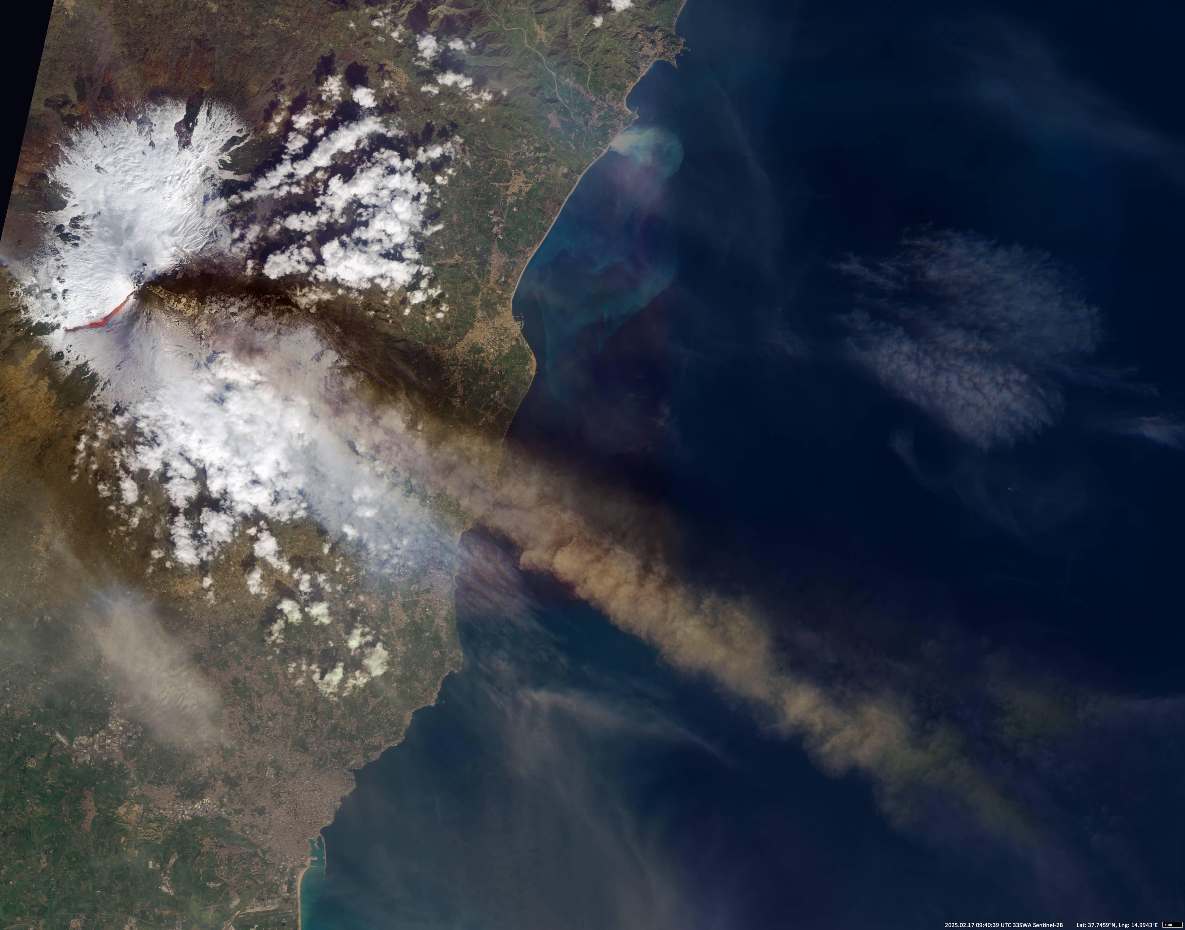
Mount Etna back to activity
East coast of Sicily | Mediterranean Sea
Date of acquisition: February 17th, 2025 | 09:40:39 UTC
Sensor: Sentinel-2B L1C
Coordinates: ca. 37.751°N, 14.996°E
Mount Etna, on the east coast of Sicily, is the largest volcano in Europe at 3,350 metres above sea level and 35 kilometers in diameter. It has an area of about 1,250 km² and several vents up to 200 metres in diameter. It is considered to be one of the most active volcanoes.
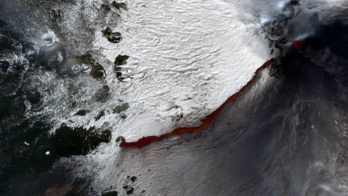
A new eruption began on 6 February and continued until the end of the month. The activity was characterized by the ejection of a lava flow from a fissure and explosive activity at the summit. A lava flow from a fissure that opened on 8 February at the base of the Bocca Nuova crater travelled down the south-west slope and reached 1,960m by 13 February. The total length of the flow was 4.2 km, and its surface area up to 300,000 square metres. The interaction of lava and snow caused phreatic explosions. Ash emissions reached 5-6 km above sea level (about 2-3 km above the summit).
On 17 February, the Sentinel-2 satellite managed to “capture” the situation as a thick cloud of volcanic ash and gases spread in a south-easterly direction. The lava flow in the image is still about 4.3 km long.
By early March, the intensity of the eruption had decreased significantly.