Winter in the Eastern Mediterranean
Eastern Mediterranean Sea
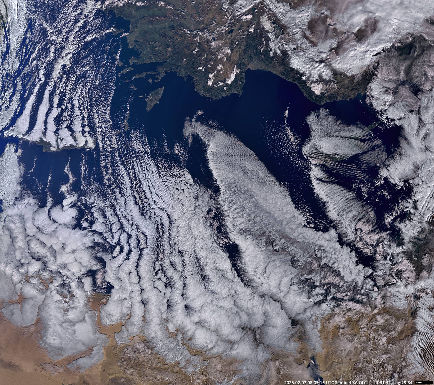
Dates of acquisition:
• 2025.02.07 | 08:05:16 UTC
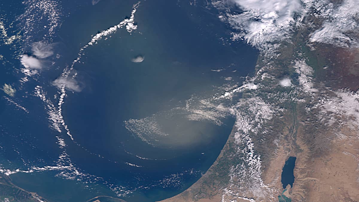
• 2025.02.16 | 07:31:38 UTC
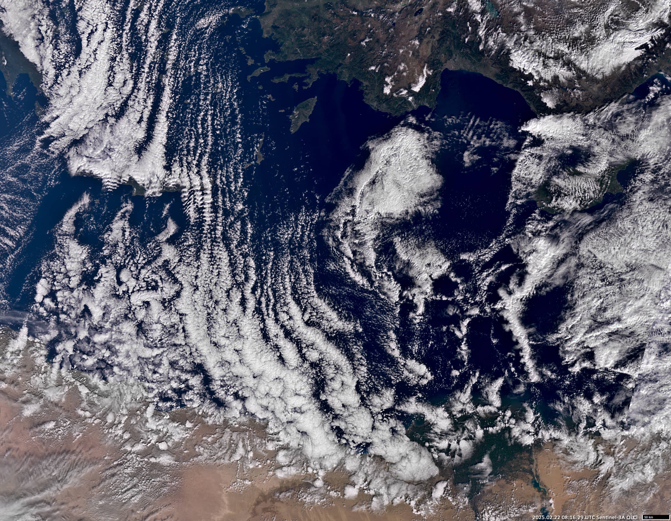
• 2025.02.22 | 08:16:29 UTC
Sensor: Sentinel-3A OLCI
Coordinates: ca. 34°N, 28°E
February is usually the coldest month of the year in the eastern Mediterranean. This year it happened almost from the beginning of the month. The inflow of cold air from the Balkans began on 5 February.
The Sentinel-3 image (Figure 1) shows cloud structures called “Convection Cells Streets” over the eastern Mediterranean Sea. These structures are formed when emissions of dry, cold continental air spread over the adjacent, relatively warm sea. The cloud cover over the water is so low so that even the mountains of Crete (~ 2km high) act as a barrier to their spread. East of Crete “Convection Cells Streets” spread unhindered to the coast of Egypt, with the width of the “Streets” and the sizes of the clouds increasing. The process reached its maximum intensity on 8 February, then began to subside and came to a halt on 13 February.
On February 16, an interesting and rare phenomenon of a sandstorm was observed over the waters near the Israeli coast, which formed in a local low pressure area (1010 hPa) (Figure 4). Cyclonic wind vortex (up to 40 km/h) formed the concentrated dust core of the storm and displaced the clouds at the fringes, where the wind speed did not exceed 10 km/h. Within a few hours, the storm moved eastwards, where pressure equalised and the storm dissipated.
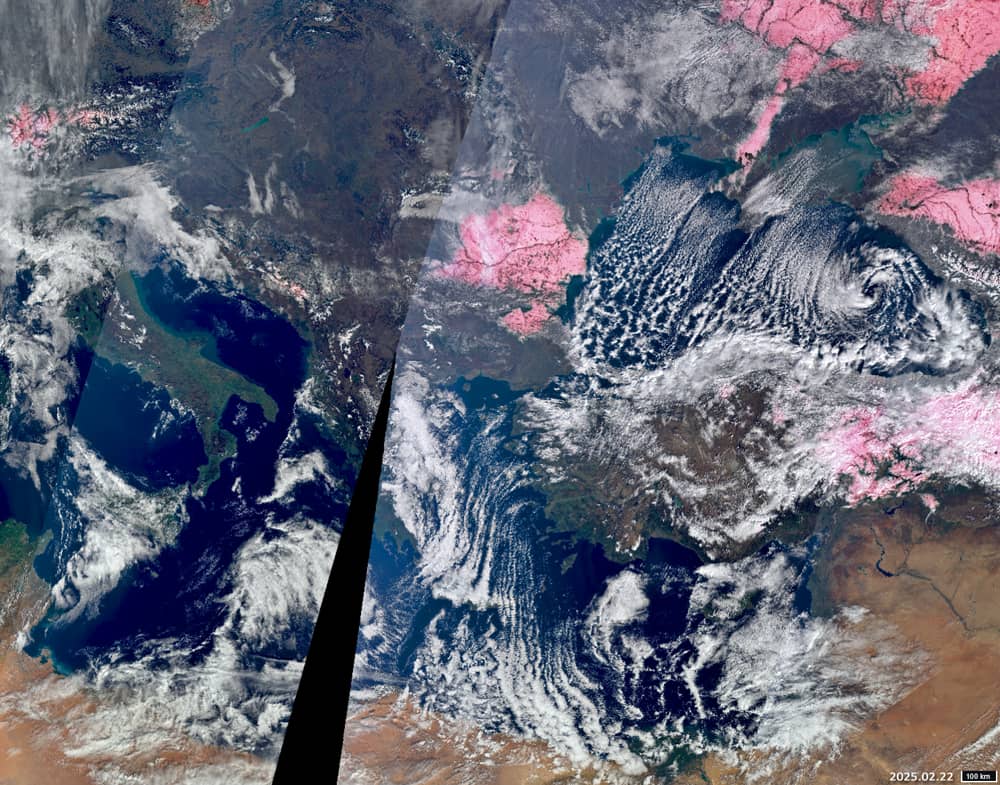
On 20 February, the strong “Cells Streets” occurred again (Figure 2). As can be seen in Figure 3, snow (pink) is present on the slopes of the Southern Carpathians, almost all of Romania, and in the north and east of Turkey. The cold also spreads southwards along the western part of the Black Sea. This situation lasted until the 25th, when warm air arrived from the west.