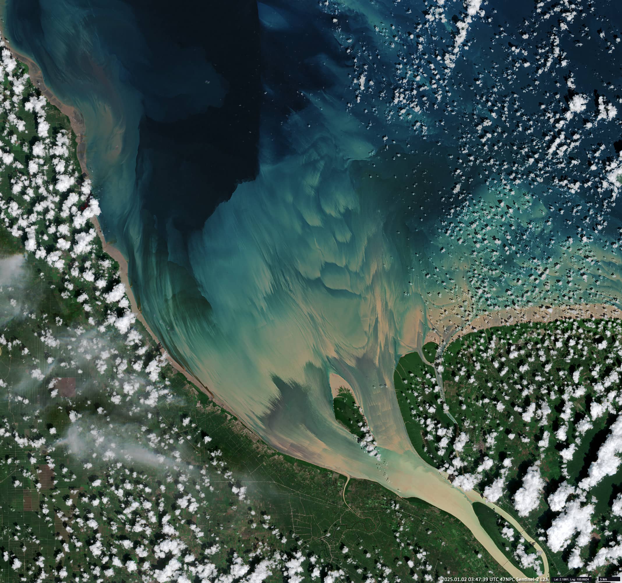
Rokan River Estuary
East of Sumatra Island | Strait of Malacca
Dates of acquisition:
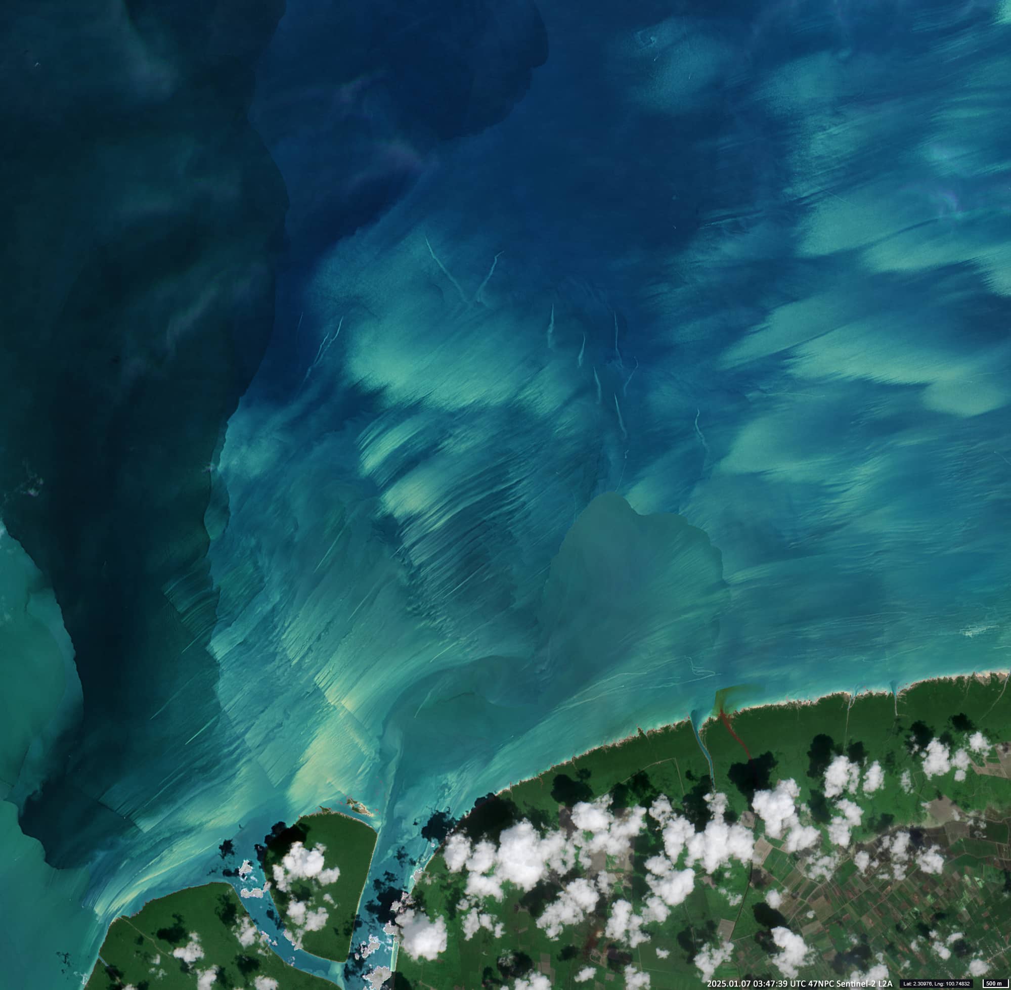
• 2025.01.07 | 03:47:39 UTC
• 2025.01.02 | 03:47:39 UTC
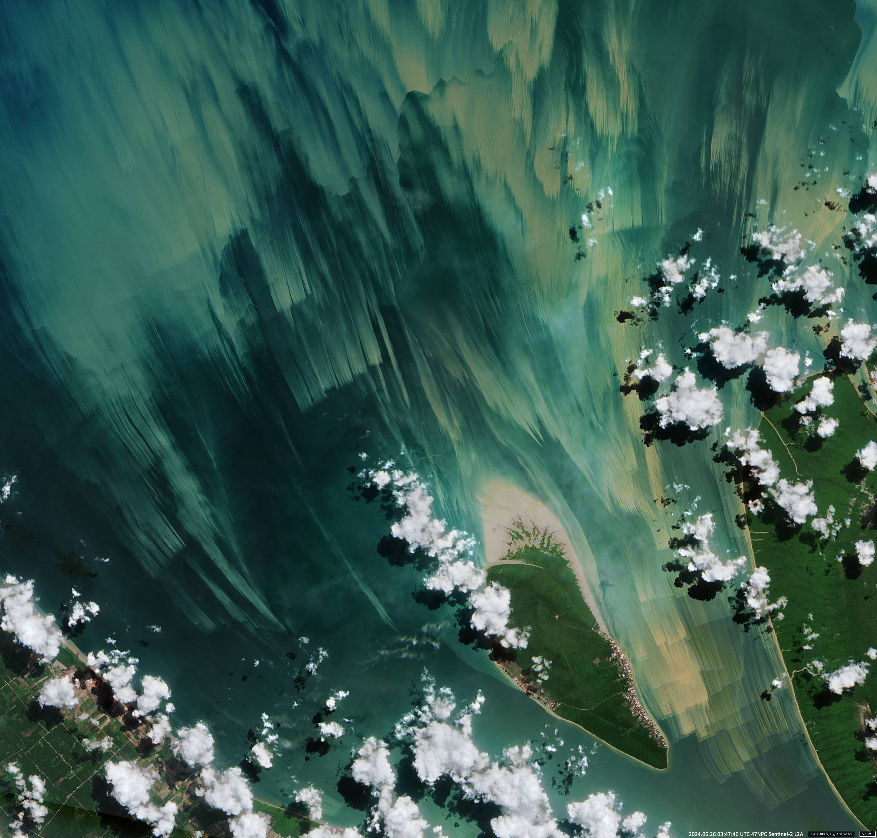
• 2024.06.26 | 03:47:40 UTC
Sensor: Sentinel-2 L2A
Coordinates: ca. 2.2°N, 100.7°E
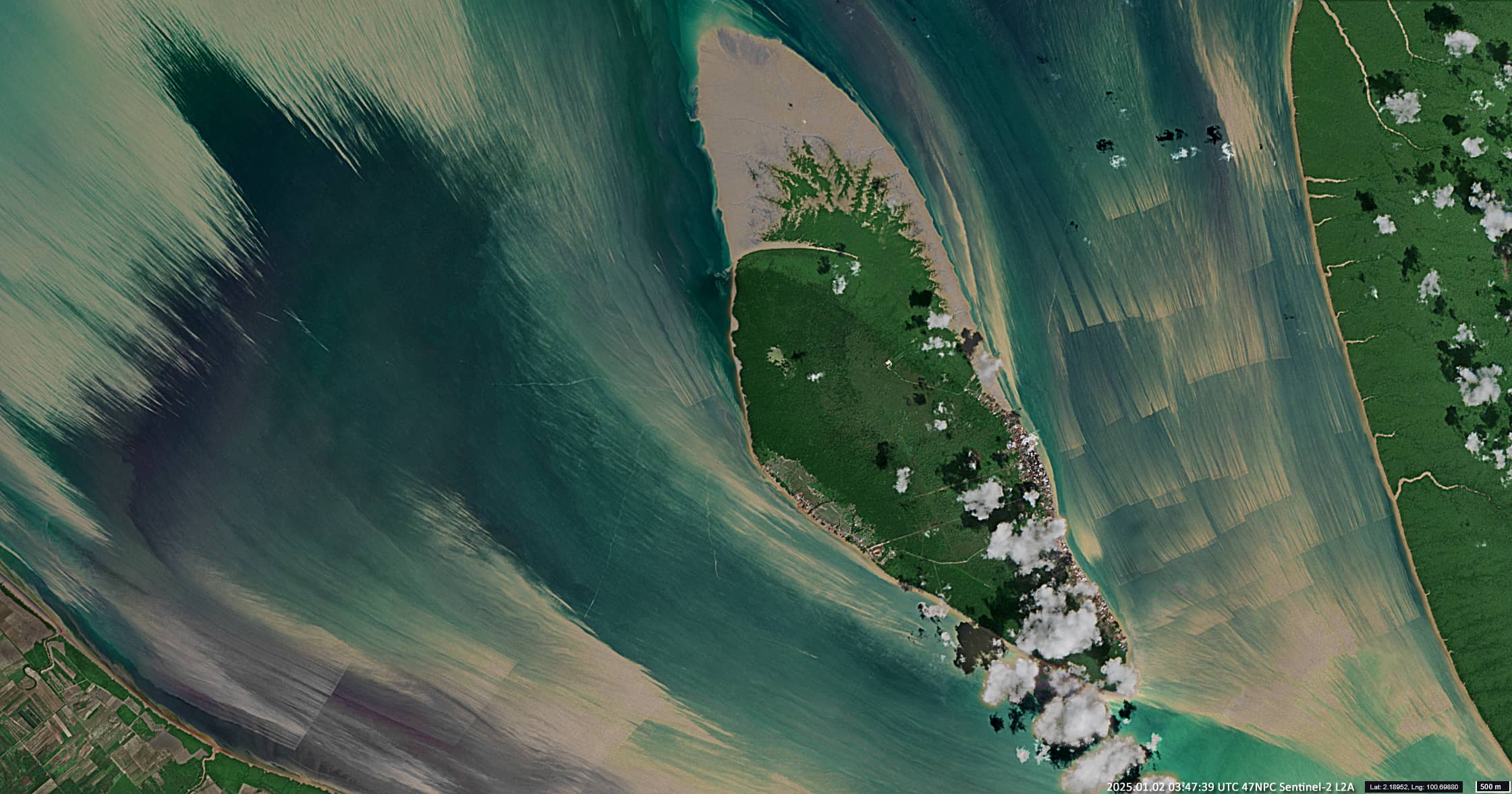
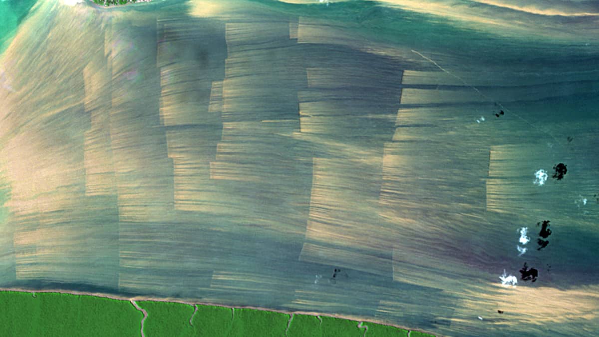
These Sentinel-2 images show the approximately 30 km long estuary of the Rokan River, which flows into the Strait of Malacca (Figure 1). In the centre of the mouth is the island of Pulau Halang (Indonesian for “blocking island”) with two fishing villages. To the east, directly on the riverbank, is the island of Berkey. The region is in the province of Riau on the island of Sumatra, Indonesia.
The interesting features of this image are the straight, stepped stripes especially in the east of Pulau, but also in other places (Figures 2, 3, 4). These shapes suggest that they are artificial in origin and have been created by human activity.
The images themselves, in which these “steps” are clearly visible, are quite rare. Although the satellites pass over the area every 5 days, the frequent dense cloud cover prevents visibility of the region when conditions in terms of height and speed of the ebb tide are optimal. Such images can be obtained only 5-7 times a year.
The estuary changes dynamically due to its hydrodynamic nature.
Firstly, the Rokan Estuary is a macro-tidal estuary with a V-shaped formation where the depth and width of the river decrease upstream. This creates a unique phenomenon known as a tidal wave, caused by the difference in hydraulic pressure between the tidal current and the river current. The wave can reach quite far downstream.
Secondly, the Rokan is known for the presence of large amounts of sediment in the form of silt and fine sand and its intensive transport downstream. This leads to sedimentation in the estuary, obstructs the current, raises the water level in the upper reaches and leads to a decrease in fishing and shipping. For example, the area of the aforementioned Berkey Island has increased almost 17 times in 35 years since 1968 due to sedimentation or flattening!
It can therefore be assumed that the straight lines shown are structures designed to prevent siltation/clogging of the river mouth or to facilitate the extraction and removal of sediment from the river bed.
Looking at satellite images with a higher sensor resolution, we can see that the straight lines are man-made structures.
They are obstacles to the flow of water that are fixed to the bed, possibly piles or supports driven into the bed at intervals of 4.5-5m. The length of a “row” structure is 350-550 metres. Dozens of such structures are scattered across the mouth of the river and on towards the Strait of Malacca. Small boats can sometimes be seen near some of them.
Satellite images clearly show plumes of suspended matter in the water immediately behind the supports. They can be 2-3 kilometres long, sometimes up to 4 kilometres. These are Karman vortex streets, chains of vortices that form when liquid flows around a cylindrical obstacle. It is thought that the presence of these eddies lifts sediment accumulated behind the piers from the bottom and carries it out of the estuary. This process slows down or even prevents further flattening.