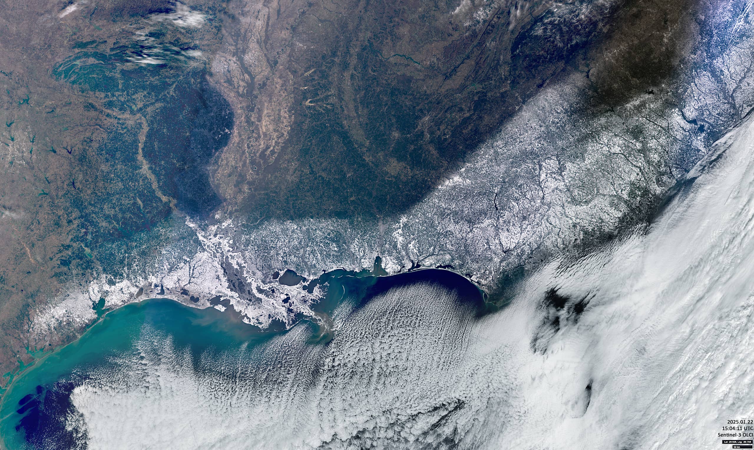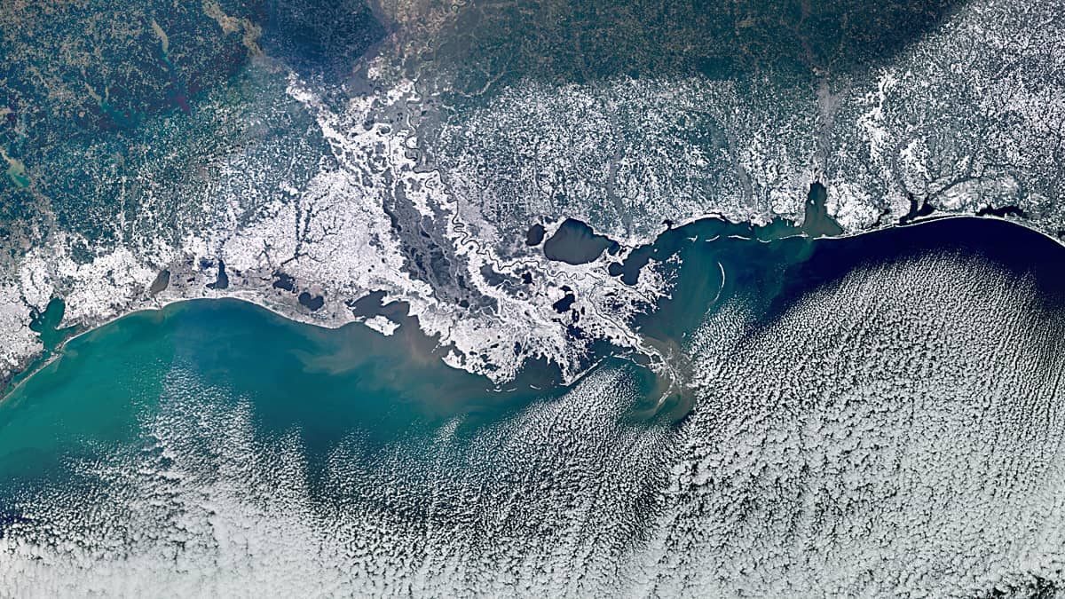
Snow on the Gulf of Mexico Coast
Gulf of Mexico
Dates of acquisition:
• 2025.01.22 | 15:04:11 UTC
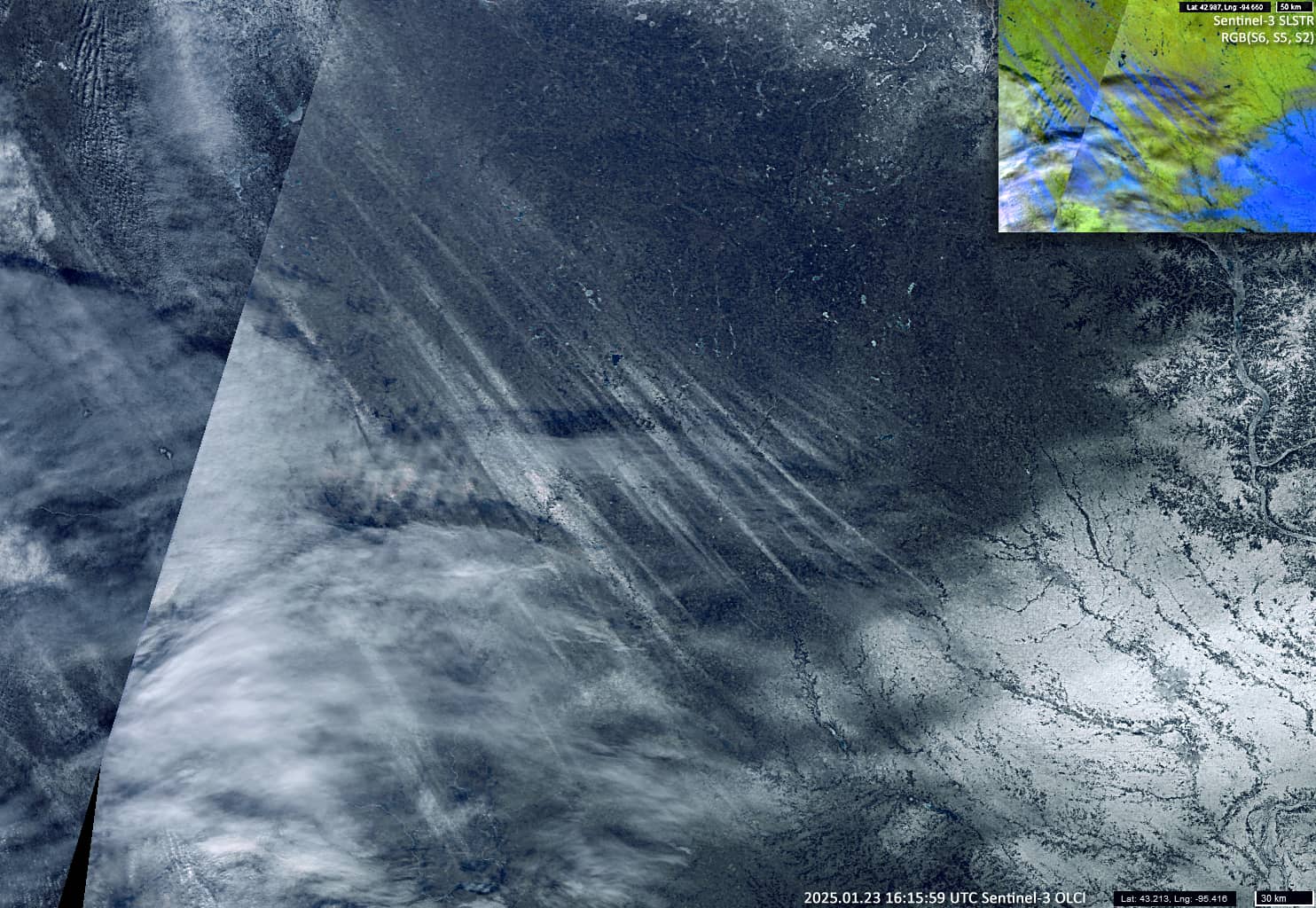
• 2025.01.23 | 16:15:59 UTC
Sensor: Sentinel-3 OLCI
Coordinates: ca. 30°N, 90°W
In late January 2025, Arctic air masses from the North American continent reached the Gulf of Mexico, where they encountered a low-pressure system over the coast. This winter storm brought unseasonably low temperatures, blizzards, and heavy snowfall to the South.
Baton Rouge airport recorded a temperature of -14°C, the lowest in 95 years of records. Wind gusts reached 50-65 km/h. About 20 centimeters of snow fell in New Orleans, more than in Anchorage, Alaska, since the beginning of this meteorological winter.
On 22 January, as the sky cleared but the cold persisted, the Sentinel-3 satellite (Figure 1) showed a broad belt of snow, up to 300 km or more in places, stretching near the coast across the southern states of Texas, Louisiana, Mississippi and on into Alabama, Georgia and the Carolinas.
The image also shows the “convection cells streets”, cloud structures that have formed above the Gulf Stream. These structures form when cold, dry continental air flows over the relatively warm ocean nearby, and are often seen over more northern regions.
A day later, there is also an image (Figure 2) showing the unusual hair-like snow “trails” from the same cold wave in northwest Iowa. These long streaks are not clouds, but actual patches of snow.