Power plants in eastern Xinjiang
Western China
Date of acquisition: January 3rd, 2025 | 04:46:53 UTC
Sensor: Sentinel-2 L2A
Coordinates: ca. 42.3°N, 93.3°E
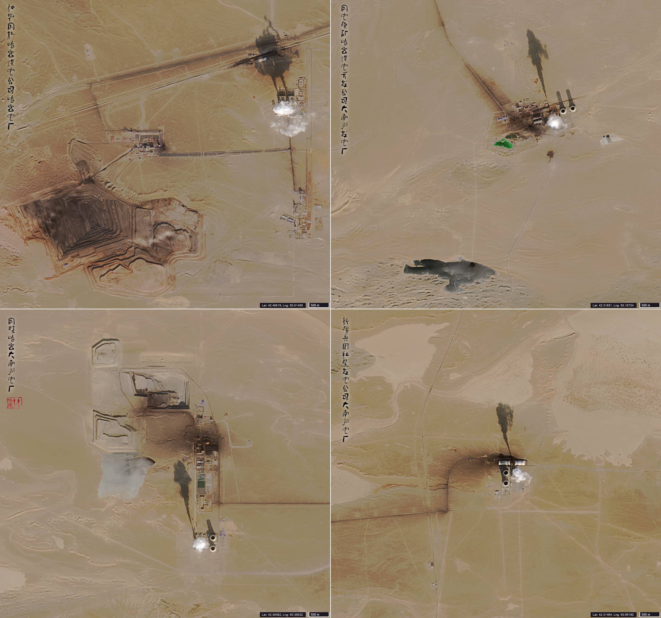
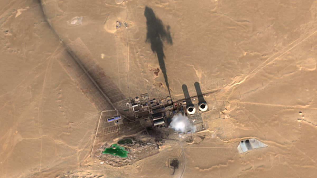
The Sentinel-2 image presented shows the Hami Depression (哈密盆地), a basin in eastern Xinjiang (新疆, شینجاڭ), located in the south of the Kumul Prefecture, an autonomous Uighur Region, western China, near the Mongolia border. It is an arid, very sparsely populated area with some of coal and iron ore deposits. The image clearly shows four industrial plants with large chimneys and smoke plumes rising steeply to a height of 800-1000 m due to high air pressure in calm weather, which can be easily calculated from the length of the shadows and the angle of the sun.
There are 4 coal-fired power plants (from west to east):
- Shenhua Guoneng Hami power station (local plant name: 神华国能哈密煤电公司哈密电厂), capacity 2640 MW
- Guodian Dananhu power station ( 国电徐矿哈密煤电开发公司大南湖发电厂), 1320 MW
- Dananhu power station ( 国投哈密大南湖电厂), 1320 MW
- XPCC Hongxing power station (新疆兵团红星发电公司大南湖电厂), 1320 MW
All power plants were built between 2015 and 2020.
The power plants are located in the middle of nowhere and have a total operating capacity of 6.6 GW. By comparison, the Belchatow power plant in Poland, the largest coal-fired power plant in the EU, has an operating capacity of about 5 GW.
Fig. 1
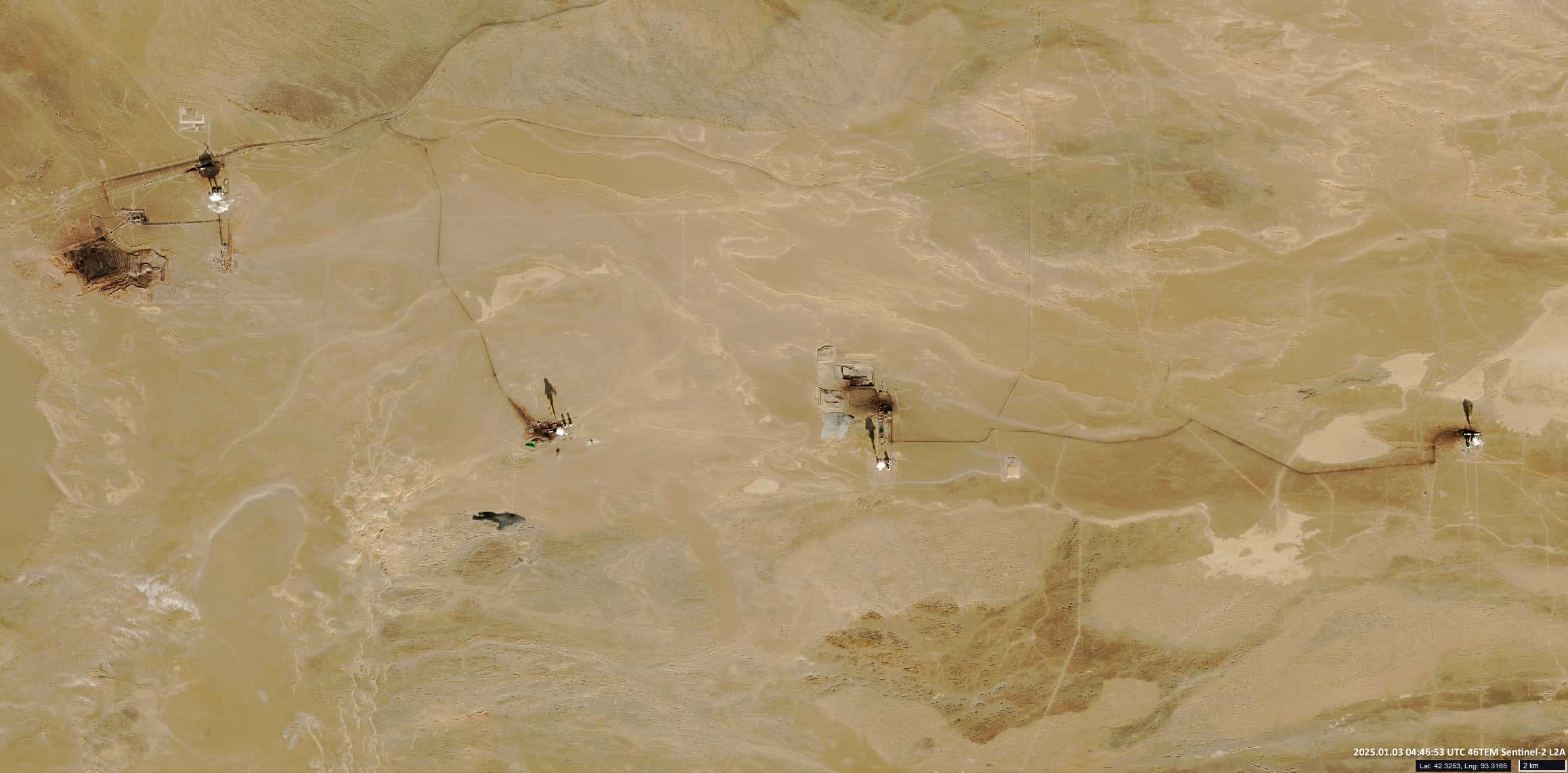
Fig. 2