Henry Bay
Southern Ocean | East Antarctic Coast
Dates of acquisition:
- September 2nd, 2024 | 00:56:03 UTC
- February 23rd, 2023 | 01:05:52 UTC
Sensor: Sentinel-2 L2A
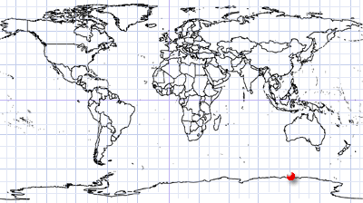
Coordinates: ca. 66°S, 121°E
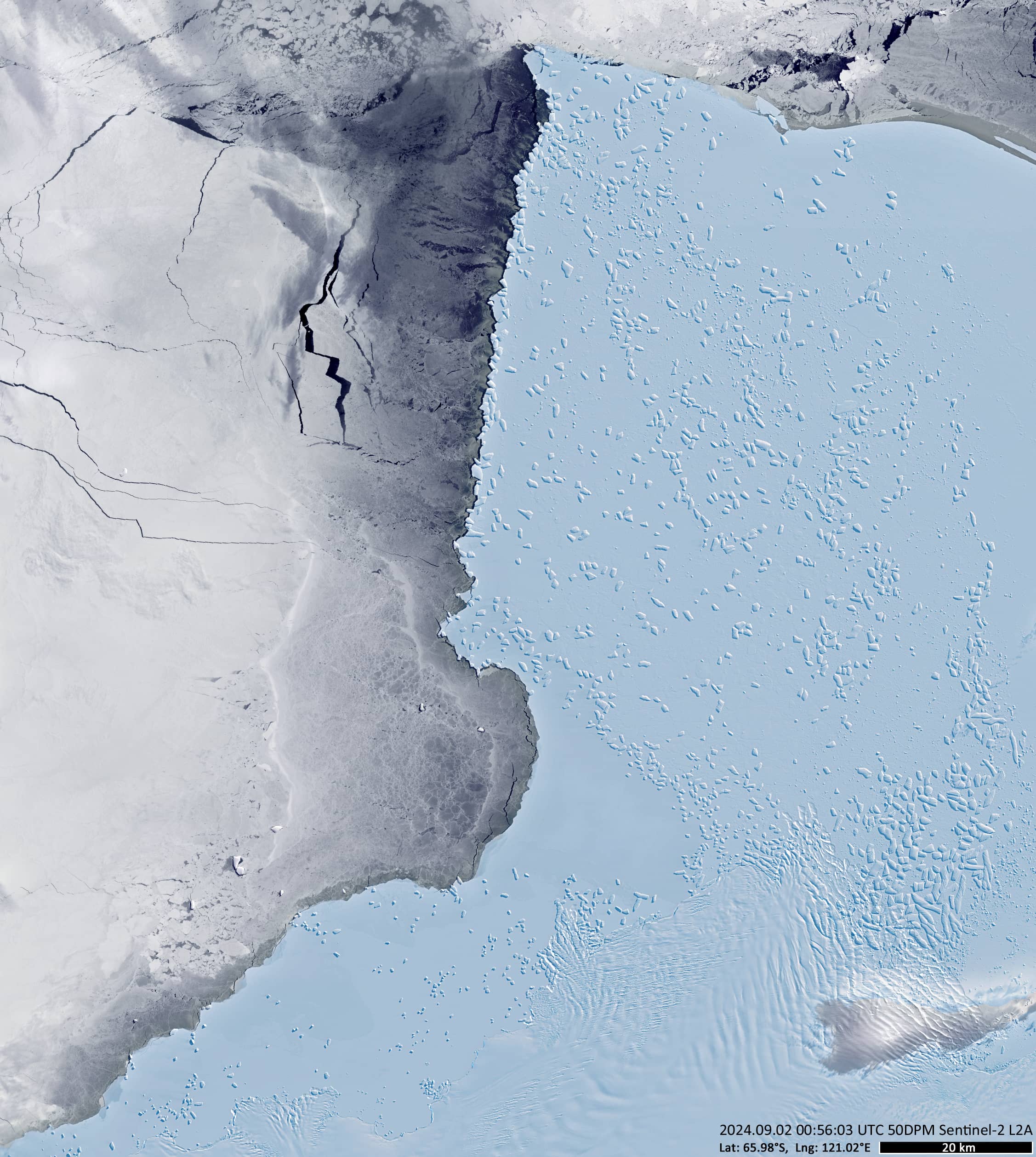
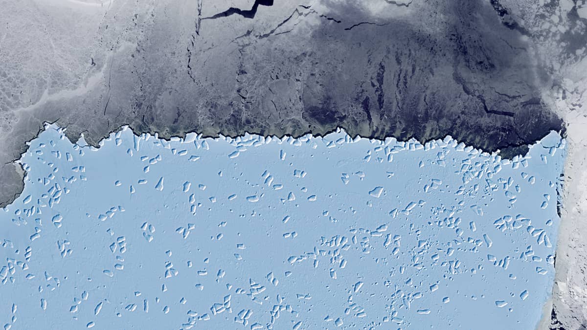
The Sentinel-2 image shows the eastern part of the Antarctic coast around Henry Bay, Sabrina Coast, Wilkes Land (Figure 1).
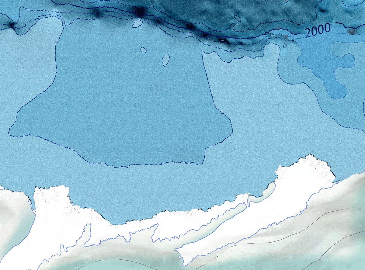
Here you can see the fast ice field with hundreds of small icebergs frozen into it. The western boundary of this field is interesting because it is almost a perfect straight line. The reason for this is hidden in the seabed.
The structure of the seabed in Henry Bay [1] consists of several deep basins and fairly sharp rises, or shoals, to the east and west. To the east, north of Cape Southard, this transition to the shallow water has a shape that approximates a straight line (Figure 2).
During the Antarctic winter, the ice on this shelf freezes to the bottom and solidifies, along with the icebergs frozen into it. The source of the icebergs is a small glacier, limited by the coastline in south and a long peninsula running parallel to the coast to the north. Although they appear small, the slightly elongated icebergs are on average 1-2 km long and several hundred metres wide. In summer, the ice thaws mostly to the bottom of the shallows, allowing the icebergs to spread out with the currents.
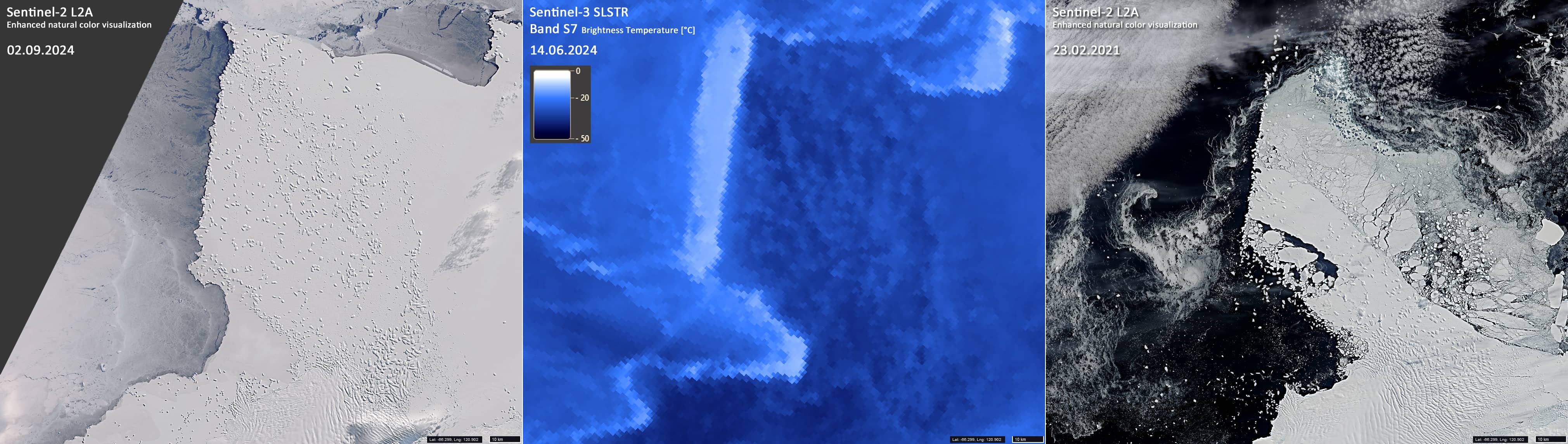
The deep part of Henry Bay does not freeze to the bottom in winter, and there is drift ice on the sea surface above, which melts in summer and allows the water to carry the icebergs away. Even in winter, possibly due to the current and upwelling, the strip of ice at the boundary to the shallow water is warmer than the surrounding (Figure 3).